


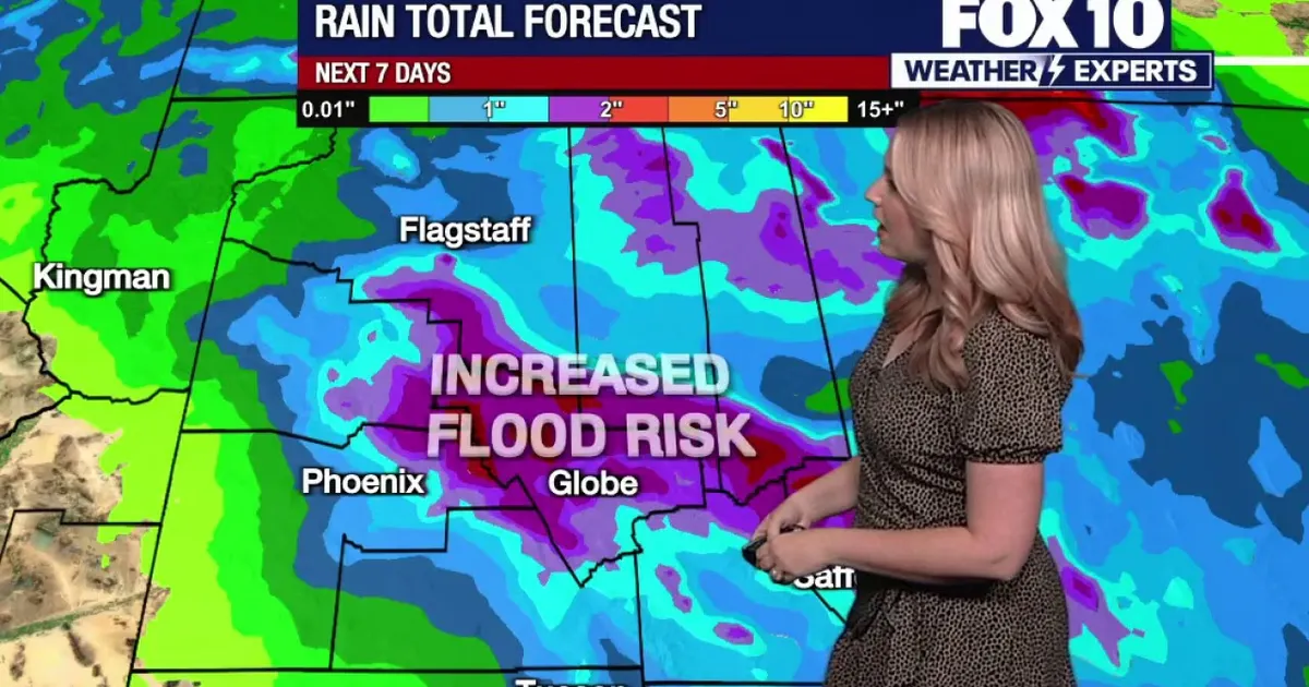
Phoenix is set for a sharp change in weather this week, with temperatures climbing to about 91F (33C) before a Pacific storm system brings a heightened risk of heavy rain, thunderstorms and flash flooding across Arizona.
Monday and Tuesday will remain warm, with partly sunny conditions and only isolated showers around Phoenix. The city is forecast to reach 89F (32C) on Monday and 91F on Tuesday, while eastern, northern and south-eastern parts of the state face a better chance of rain.
The National Weather Service in Phoenix said a low-pressure system moving inland from the Pacific would draw unusually high levels of moisture into the Desert Southwest from Tuesday night. That is expected to produce several rounds of showers and thunderstorms, particularly across south-central and eastern Arizona.
Flash-flood risk increases across Arizona
Rain and storm chances are expected to be highest on Wednesday and Thursday, when Phoenix has about a 60 per cent chance of showers or thunderstorms. The most intense storms could bring gusty winds, small hail and rainfall heavy enough to trigger sudden flooding.
The Weather Prediction Center has placed Phoenix and areas to the north and east under a slight risk for excessive rainfall leading to flash flooding on both days. Forecasters say the greatest danger is likely to be in foothill and higher-terrain areas, although the Phoenix metropolitan area could also be affected.
Current projections suggest between 0.25in and 1in (6mm to 25mm) of rain across the lower deserts, with 1in to 2.5in possible in higher elevations. Some thunderstorms could produce rainfall rates of more than 1in an hour, increasing the risk of rapidly rising water and flooded roads.
Temperatures should fall as the storm system arrives, dropping to the mid-80s on Wednesday and the low 80s on Thursday. Drier, brighter conditions are expected to return towards the weekend, with overnight temperatures easing back into the upper 50s and low 60s.
