


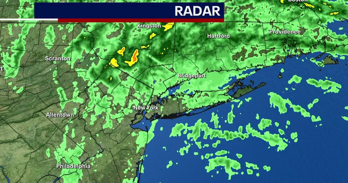
Flooding and travel disruption are continuing across the New York metropolitan area as a powerful nor’easter weakens, with rain expected to clear by around lunchtime on Monday, September 28.
Coastal flood advisories remain in force until at least 2pm, particularly across Long Island as high tide raises water levels in vulnerable waterfront communities.
The National Weather Service said minor flooding could continue during high-tide cycles, with locally moderate inundation possible along Long Island’s southern and eastern bays and its north shore. Some of the most exposed areas could see up to 1½ft of water above ground level, locally reaching 2ft. ([forecast.weather.gov](https://forecast.weather.gov/product.php?glossary=1&highlight=off&issuedby=okx&product=afd&site=nws&version=1&utm_source=openai))
Roads in parts of New York City, Long Island and Westchester County have been affected since Friday. The National Weather Service recorded two to three feet of flooding in parts of Broad Channel and Old Howard Beach in Queens, while homes and parking areas were inundated near the Hudson River in Piermont. ([forecast.weather.gov](https://forecast.weather.gov/product.php?format=CI&glossary=1&highlight=off&issuedby=OKX&product=LSR&site=NWS&version=38&utm_source=openai))
On Long Island, severe flooding also forced the Long Island Rail Road to suspend some local services and replace trains with buses. Drivers have been warned not to enter flooded roads.
Winds have eased considerably, averaging about 10 to 15mph, although gusts of up to 25mph are still possible. That is a marked reduction from the winds of more than 50mph recorded during the weekend, which helped produce waves of about 10ft along the Jersey Shore.
The storm has already had a fatal consequence in New York City. A 56-year-old man died after being struck by a falling tree in Brooklyn on Saturday, according to the New York City Fire Department. The city’s emergency management officials said winds reached up to 55mph, with stronger gusts recorded during the storm. ([fox5ny.com](https://www.fox5ny.com/news/person-hit-fallen-tree-brooklyn-amid-weekend-noreaster?utm_source=openai))
Temperatures are expected to remain in the upper 50s to mid-60s Fahrenheit as the rain retreats. Tuesday should be dry but cloudy at first, with skies clearing later in the day.
Forecasters expect warmer conditions to return midweek, with temperatures reaching the 70s on Wednesday and potentially nearing 80F on Thursday.
