


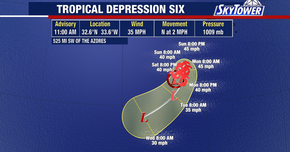
Forecasters are tracking Tropical Depression Six in the eastern Atlantic, where the system could briefly strengthen into Tropical Storm Fay before weakening over open water.
The National Hurricane Center said the depression was centred about 525 miles (845km) south-west of the Azores on Saturday, with maximum sustained winds of 35mph and higher gusts. It was moving slowly northwards.
If it reaches tropical-storm strength, it will take the name Fay and become the sixth named storm of the 2026 Atlantic hurricane season.
Tropical Depression Six forecast to weaken
The system is expected to move north-east over the next 24 to 36 hours before turning towards the south-west. Meteorologists forecast a modest increase in strength during the next day or so, followed by gradual weakening as it encounters stronger wind shear.
The National Hurricane Center expects the depression to become a post-tropical remnant low by Tuesday, 22 September, and to dissipate by Wednesday, 23 September, although forecasters said there remains some uncertainty over its exact lifespan.
No coastal watches or warnings are in force, and officials said Tropical Depression Six is not expected to affect the Azores, the United States mainland or any other landmass.
The system formed from a low-pressure area that had been monitored south-west of the western Azores, where showers and thunderstorms became increasingly concentrated around its centre.
