


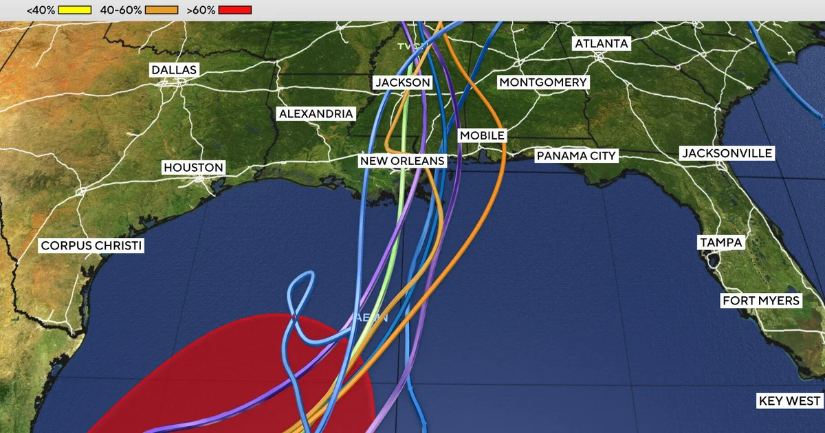
Tropical Depression Nine is strengthening in the southern Gulf and could become the Atlantic season’s ninth named storm, with the system expected to reach the Gulf Coast this weekend.
The depression formed on Tuesday over warm waters off Mexico. Forecasters expect it to become a tropical storm by early Wednesday and potentially reach hurricane strength on Thursday.
If it is upgraded to a tropical storm, it will be named Isaias, pronounced “ees-ah-EE-ahs”. Forecast models are increasingly agreeing that the system will move northwards towards the Gulf Coast.
Heavy rain expected across the Gulf Coast
Regardless of whether the system is named or strengthens further, moderate to heavy rain is expected across the Gulf Coast and much of the south-eastern United States from this weekend into early next week.
Some longer-range forecasts indicate that moisture from the system could reach the Ohio Valley and the north-east by the middle of next week.
However, the timing, intensity and severity of the storm’s impact on land remain uncertain. Some models suggest conditions could begin deteriorating on Friday evening, while others show the effects arriving later in the weekend.
Why Isaias would be a notable name
The Atlantic hurricane season has produced eight named storms since it began on June 1. It is due to end on November 30, while El Niño continues to contribute to a more active season in the Pacific.
Storms given names beginning with the letter I have historically been among the most frequently retired in the Atlantic basin. Ian in 2022, Ida in 2021, Irma in 2017 and Irene in 2011 are among the best-known examples.
Isaias replaced Ike on the Atlantic tropical cyclone list after Ike was retired in 2008. The list of names is rotated every six years.
