


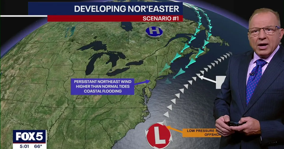
A potential nor’easter is expected to bring strong winds, high surf and coastal flooding to the New York City area from Friday into the weekend, although forecasters say the storm’s exact track remains uncertain.
The developing coastal system could affect New York, New Jersey and Connecticut with prolonged onshore winds, rising tides and hazardous conditions along the coast. The most significant impacts are expected during high tide periods from Friday afternoon into Saturday.
National Weather Service forecasters say the storm will strengthen as it approaches the I-95 corridor. Peak gusts of between 35mph and 50mph are possible across the Tri-State area, with the strongest winds expected in eastern Long Island and south-eastern Connecticut.
New York nor’easter forecast and timeline
Winds in New York City and inland areas are expected to reach about 25mph to 30mph on Wednesday, with gusts of up to 36mph around Montauk and stronger winds offshore.
Conditions are forecast to deteriorate on Thursday, when gusts could reach 30mph to 35mph across New York City and western Long Island. Eastern Long Island may see gusts approaching 39mph, while offshore winds could reach between 49mph and 55mph.
From Friday through Sunday, the Tri-State area could experience the strongest winds of the event, together with periods of rain and high ocean swells. Coastal flooding is expected to be most widespread around the high tides on Friday and Saturday.
Southern Nassau County, Queens and coastal parts of Connecticut west of New Haven are considered among the areas at greatest risk of flooding. Beach erosion, dune damage and structural flooding are possible along exposed sections of Long Island and the Queens coastline.
Ocean beaches in Long Island and New Jersey are also likely to face dangerous rip currents, high surf and localised erosion. Persistent waves and already elevated astronomical tides could worsen the effects even if the storm remains offshore.
Forecast models currently disagree over how close the low-pressure system will pass to the coast. One scenario brings a stronger storm nearer to New Jersey, potentially producing heavy rain, gusts of around 50mph and a substantial storm surge, while another keeps the system farther out to sea, limiting New York City mainly to breezy weather and some rain.
Forecasters say rainfall totals will depend largely on the storm’s final position. Regardless of the precise track, coastal communities are being warned to monitor updates as the system develops and to prepare for flooding, rough seas and difficult conditions along exposed shorelines.
