


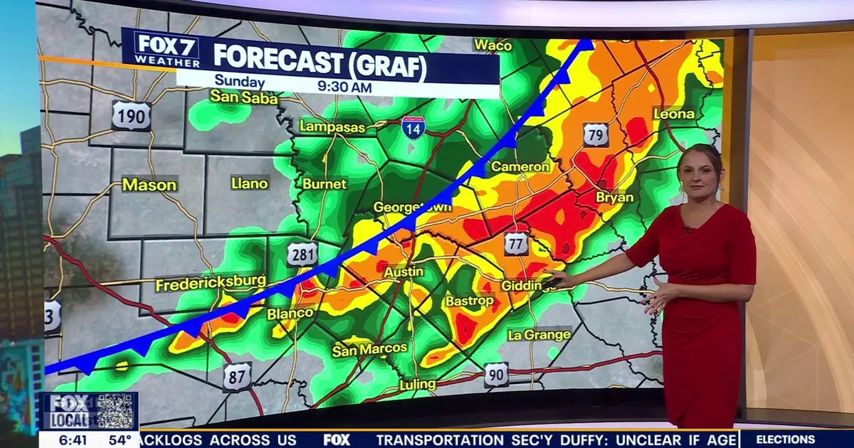
A cold front brought heavy rain, gusty winds and a sharp fall in temperatures to Austin on Sunday 15 November, ending a spell of unseasonably warm weather across Central Texas.
The front reached the Austin metropolitan area at about 8am, sending showers and isolated thunderstorms across the region. Lightning was reported earlier near Junction and Mason, but the storms weakened as they moved east and there was little indication of a significant severe-weather threat. ([fox7austin.com](https://www.fox7austin.com/weather/austin-weather-stormy-weather-expected-central-texas-weekend?utm_source=openai))
Forecasters warned of a low risk of localised flooding east of Interstate 35 as the weather system headed towards the Gulf Coast. Wind gusts of between 20mph and 30mph accompanied the heaviest rain.
Once the downpours eased, grey skies, mist and intermittent drizzle were expected to linger into the early hours of Monday.
Chilly conditions set to continue
Temperatures were already in the low 50s early on Sunday, including 52F in downtown Austin, 53F in Mason, and 50F in both Rockdale and Lampasas. The mercury was expected to remain in the 50s throughout the day, a marked contrast with Friday’s high of 80F and well below the seasonal average of 72F.
Monday will bring morning temperatures in the 40s and afternoon highs in the 50s, with a small chance of early drizzle before skies begin to clear. Drier air moving in from the north is expected to reduce humidity as the week begins.
Temperatures should recover into the 60s on Tuesday, while a gradual warming trend is forecast to take highs back into the 70s by Thursday. Humidity will increase later in the week, bringing a renewed but limited chance of rain. ([fox7austin.com](https://www.fox7austin.com/weather?utm_source=openai))
