


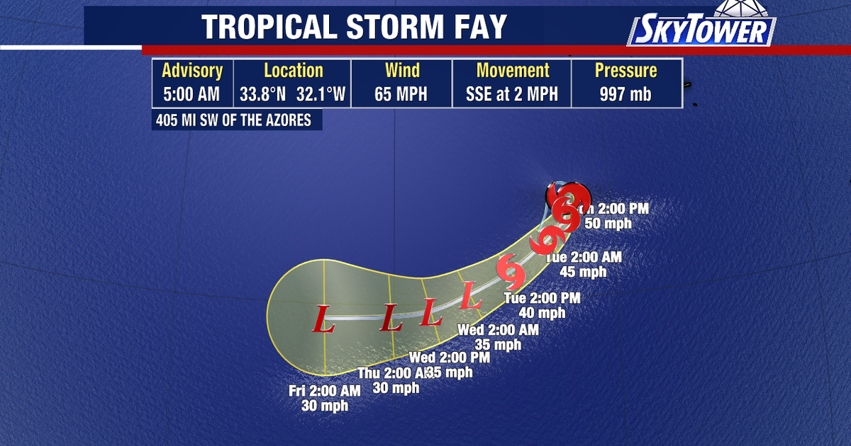
Tropical Storm Fay has weakened over the open Atlantic after briefly approaching hurricane strength, with no threat to the United States or any other land area, forecasters said.
At 9am GMT on Monday, 21 September, Fay was around 405 miles (655km) south-west of the Azores, with maximum sustained winds of 65mph (100km/h). The storm was moving slowly south-east and had no coastal watches or warnings in effect.
The National Hurricane Center said Fay had begun to weaken as strong vertical wind shear disrupted its circulation. Dry air was also expected to hinder the storm, with forecasters predicting a steady decline in strength over the next few days.
Fay had come close to hurricane status overnight, when its winds reached about 70mph (110km/h). A hurricane requires sustained winds of at least 74mph (119km/h).
Forecast guidance indicates the system will continue drifting south-west across the eastern Atlantic before becoming a post-tropical cyclone by Wednesday. The National Hurricane Center expects Fay to dissipate by Saturday, 26 September.
The storm’s position leaves it much closer to Europe and Africa than North America. Forecasters said no new tropical cyclone formation was expected in the Atlantic, Caribbean Sea or Gulf of America during the next seven days.
