


Houston is set for a brief break from oppressive humidity on Saturday, September 26, with drier air bringing dew points down into the 60s before temperatures climb into the low to mid-90s.
The change will be noticeable rather than seasonal. Forecasters expect partly cloudy conditions across the city, with little or no rain during the day and afternoon temperatures reaching about 92F (33C). The National Weather Service said heat indices should remain below 100F.
The lower humidity is expected to last through the first part of the weekend, offering some relief despite another hot day across the Houston area.
An Ozone Action Day is also in effect on Saturday for Houston, Galveston and Brazoria counties. The Texas Commission on Environmental Quality warned that conditions could favour elevated ozone levels and urged residents to limit activities that contribute to air pollution.
Storm chances rise in Houston next week
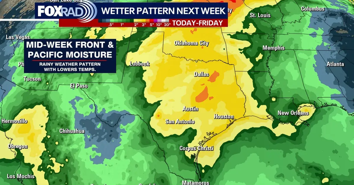
The quieter spell will not last. Rain and thunderstorm chances are forecast to increase from the middle of next week as a cold front moves across Texas.
National Weather Service projections show storm chances rising sharply on Wednesday and Thursday, with temperatures easing as wetter weather moves in. The front could also draw additional moisture northwards from the eastern Pacific, increasing the potential for periods of heavy rain.
Houston is forecast to remain in the low 90s through Tuesday before temperatures dip to around 91F on Wednesday and 88F on Thursday as the unsettled pattern develops.
In the Atlantic, Tropical Storm Fay was weakening far from land and was not expected to pose a threat to coastal areas. Tropical Storm Gonzalo was also forecast to weaken as it moved northwards, with strong wind shear expected to limit its development. ([nhc.noaa.gov](https://www.nhc.noaa.gov/mobile/?trk=public_post-text&utm_source=openai))
