


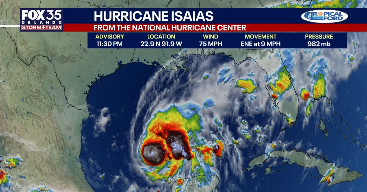
Tropical Storm Isaias is expected to strengthen into a hurricane as it moves towards the northern Gulf Coast, with forecasters warning of dangerous coastal flooding, damaging winds and torrential rain from late Friday.
The storm was about 200 miles west-north-west of Progreso, Mexico, late on Wednesday, moving east-north-east at 8mph with maximum sustained winds of 65mph. The National Hurricane Center said it was likely to reach hurricane strength on Thursday morning before turning north towards the United States. ([nhc.noaa.gov](https://www.nhc.noaa.gov/archive/2026/al09/al092026.public.005.shtml?utm_source=openai))
Isaias is the ninth named storm of the 2026 Atlantic hurricane season. It is forecast to pass north of Mexico’s Yucatán Peninsula before approaching the US Gulf Coast, with landfall possible late on Friday or early on Saturday.
Hurricane watches issued along Gulf Coast
A hurricane watch is in force from Bay St Louis in Mississippi to Indian Pass in Florida, meaning hurricane conditions are possible within the watch area. Tropical storm watches extend across parts of coastal Louisiana and Florida, while a storm surge watch covers the area from the mouth of the Mississippi River to Yankeetown.
The National Hurricane Center said storm surge could raise water levels by between five and seven feet above normally dry ground from Ocean Springs, Mississippi, to Indian Pass, including Mobile Bay. The worst flooding is expected near and to the east of where the storm reaches the coast.
Isaias could produce between three and seven inches of rain from south-eastern Louisiana to the Florida Panhandle, with isolated totals of up to 10 inches. Heavy downpours could trigger flash flooding, flooding on roads and isolated river flooding.
Rainfall of one to three inches is also possible across much of the south-eastern United States, including the Tennessee Valley and the Carolinas. Forecasters warned that bands of thunderstorms could bring isolated tornadoes along the north-eastern Gulf Coast on Friday night, with the risk spreading inland on Saturday.
Florida prepares for heavy rain and coastal flooding
Florida Governor Ron DeSantis declared a state of emergency for 25 counties on Tuesday as officials prepared for the storm’s potential impact. The Florida State Emergency Response Team has been positioning generators, fuel, flood barriers, food, tarpaulins, sandbags and other supplies around Tallahassee and Santa Rosa County. ([flgov.com](https://flgov.com/eog/news/press/2026/governor-ron-desantis-issues-executive-order-preparation-tropical-depression-nine?utm_source=openai))
The storm is not expected to pose a direct threat to Orlando or Tampa, although parts of the Florida Panhandle remain within the projected path. Central Florida could still see further heavy rain after an exceptionally wet spell.
More than nine inches of rain has fallen in parts of Heathrow, Lake Mary, Flagler Beach and northern Ocala over five days. The deluge followed the driest start to a year recorded in the Orlando area since records began in 1892.
Large waves and dangerous rip currents are also expected around the Yucatán Peninsula before spreading towards the US Gulf Coast. Residents in affected areas have been urged to monitor updates from the National Hurricane Center and their local National Weather Service office.
