


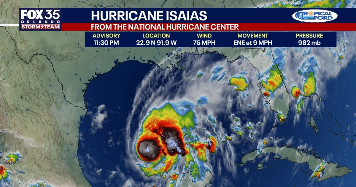
Hurricane Isaias is bearing down on the US Gulf Coast after becoming the first hurricane of the 2026 Atlantic season, with forecasters warning of dangerous storm surge, damaging winds and torrential rain.
The storm is expected to make landfall between the Mississippi coast and the Florida Panhandle late on Friday or early on Saturday. A hurricane watch is in force from Bay St Louis, Mississippi, to Indian Pass, Florida, while a tropical storm watch covers parts of Louisiana and the Florida coast.
Isaias was moving east-north-east after passing north of Mexico’s Yucatán Peninsula. The National Hurricane Center said the system had maximum sustained winds of about 75mph, with tropical-storm-force winds extending more than 100 miles from its centre.
Hurricane Isaias threatens northern Gulf Coast
A storm surge watch has been issued from the mouth of the Mississippi River to Yankeetown, Florida. Water levels could rise by between five and seven feet above normally dry ground from Ocean Springs, Mississippi, to Indian Pass, including Mobile Bay.
Forecasters said the highest surge was likely near and to the east of where the hurricane reaches the coast, with large waves expected to worsen flooding along exposed beaches and bays.
Isaias could deliver between three and seven inches of rain across south-eastern Louisiana and the Florida Panhandle from Friday through the weekend. Isolated totals of up to 10 inches are possible, raising the risk of flash flooding, flooded roads and river flooding.
Rainfall of between one and three inches is also expected across parts of the wider south-eastern United States, including the Tennessee Valley and the Carolinas. Isolated totals could reach five inches.
The threat of tornadoes is forecast to increase along the north-eastern Gulf Coast on Friday evening and overnight, with the risk spreading inland as the system moves north.
Officials in Florida have declared a state of emergency for 25 counties, including communities across the Panhandle and Big Bend regions. The state emergency response team is preparing generators, fuel, flood barriers, water, meals, tarpaulins and sandbags.
Alabama has declared a state of emergency for 40 counties, while local authorities in coastal communities have urged residents in low-lying areas to prepare for possible flooding.
Isaias is arriving after an unusually wet spell in parts of central Florida. More than nine inches of rain has fallen over five days in some areas around Heathrow, Lake Mary, Flagler Beach and northern Ocala, leaving already saturated ground vulnerable to further flooding.
The storm’s formation comes unusually late in the season and is close to the record for the latest first Atlantic hurricane, set in 1905 when the season’s first hurricane formed on 8 October.
Residents along the Gulf Coast have been advised to monitor updates from the National Hurricane Center and local weather authorities, with further watches and warnings possible as Isaias approaches.
