


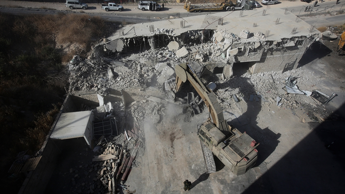
Israel is using artificial intelligence to monitor Palestinian land and accelerate home demolitions in the occupied West Bank, according to researchers and rights activists who say the technology is helping to drive forced displacement.
The system, known as ImiSight, was developed by Israeli weapons manufacturer Rafael. It analyses aerial imagery, detects changes to the landscape and identifies structures that authorities may classify as unauthorised.
Rights groups say the technology was first deployed in the Naqab desert, where it was used to monitor Bedouin Palestinian communities living in villages that are not recognised by the Israeli authorities. Many residents have few prospects of obtaining building permits.
When the system flagged changes described as unauthorised construction, bulldozers were subsequently sent in, according to reports citing rights activists and Israeli media.
Israel has now brought the model to the West Bank, where Palestinian homes have long been demolished over alleged planning violations. Activists say the permit system makes it extremely difficult for Palestinians to build legally.
AI-powered demolitions in the West Bank
An enforcement unit within the Israel Land Authority was established in April 2025 to operate in the West Bank. Israeli rights group Peace Now described the move as a “step of annexation”, saying the authority used “advanced technological tools, based on artificial intelligence, for detecting encroachments”.
Amir Daoud, head of documentation and publication at the Colonisation and Wall Resistance Commission, said the unit represented an escalation because it transferred a surveillance and eviction model from the Naqab into occupied territory.
“The political danger begins with establishing a district affiliated with the Israel Land Authority to operate inside the West Bank. This means introducing an Israeli civilian government apparatus directly into an occupied territory,” he said.
Advances in satellite technology have also reduced the time needed to process aerial images. Khaled Safi, a Palestinian digital media and technology expert, said newer satellites could analyse images in orbit before sending selected information back to Earth.
“It takes the picture, analyses it, identifies changes and important objects, and then sends the result or just the important part to Earth,” he said, describing the satellites as “edge computing” terminals operating in space.
Israeli media reported in January 2025 that ImiSight had enabled the Land Authority to survey more than 10,700 square kilometres in the Naqab. The same reports said the system had contributed to the forced eviction of more than 2,600 Palestinian Bedouin citizens of Israel.
Peace Now and Kerem Navot, another Israeli rights organisation, recorded an 80 per cent rise in demolitions in Area C of the West Bank and occupied East Jerusalem when comparing 2010-22 with 2023-25. Area C is under complete Israeli military and administrative control.
The groups said an average of 966 buildings were demolished each year between 2023 and 2025. In the first nine months of 2025 alone, Israeli forces destroyed 1,288 Palestinian structures, according to the figures cited.
Daoud said the technology acted as a “force multiplier” by scanning large areas, highlighting recent changes and speeding up the process from warning to demolition.
“The government makes the decision of decisive displacement, and the algorithm lowers the cost of executing it,” he said.
Concerns over automated enforcement
The AI system is also being supplied with information from Israeli settler patrols, which activists say have become intelligence-gathering networks through the use of drones and cameras.
The Israeli government allocated 33 million shekels, equivalent to around nine million dollars, to settler patrols in 2023. A further 40 million shekels, or about 13.2 million dollars, was allocated to equip outposts with drones and cameras.
Safi warned that removing meaningful human oversight from decisions affecting vulnerable communities risked turning questions of life and property into calculations based on images and probabilities.
“This allows the criminal to disperse responsibility and escape it, making it fall either on the algorithm, the institution or another unknown entity,” he said.
The use of automated enforcement has coincided with a wider expansion of Israeli settlements. Between 2023 and 2025, plans were advanced for more than 40,000 settler homes and 185 new outposts, all of which are illegal under international law.
Over the same period, 118 Palestinian shepherding communities were expelled from the West Bank, according to the figures cited. United Nations humanitarian data and Peace Now estimate that about 750,000 Israeli settlers now live in the occupied territories.
Settler violence also reached a record level in 2025, with 1,836 attacks against Palestinians recorded, according to the same data.
Palestinian authorities have separately condemned the launch of an online land registry in Area C, describing it as a digital mechanism intended to help complete administrative annexation.
Daoud said the system exposed what he described as a double standard: Palestinian buildings were identified and moved quickly towards demolition, while settler outposts received funding and services before efforts were made to legalise them retrospectively.
Israel’s military and ImiSight were approached for comment but had not responded.
Safi said the West Bank was being used not only as a surveillance environment but also as a testing ground for technologies that could later be marketed to commercial customers.
