


Recent thunderstorms haven’t been enough to offset a warm, sunny start to June, and drought is spreading rapidly across Minnesota.
Despite some recent hit-and-miss thunderstorms, drought is rapidly expanding. June is a tough time of year to make real progress on dry conditions.
The longest days of the year, combined with the strongest sunlight of the year, dry soils quickly on warm, sunny days. Late May into the first third of June has been much warmer than normal with lots of sun and spotty, localized rains.
The latest drought monitor shows nearly one-third (32 percent) of Minnesota is now in at least moderate drought. That’s up from just 14 percent a week ago.
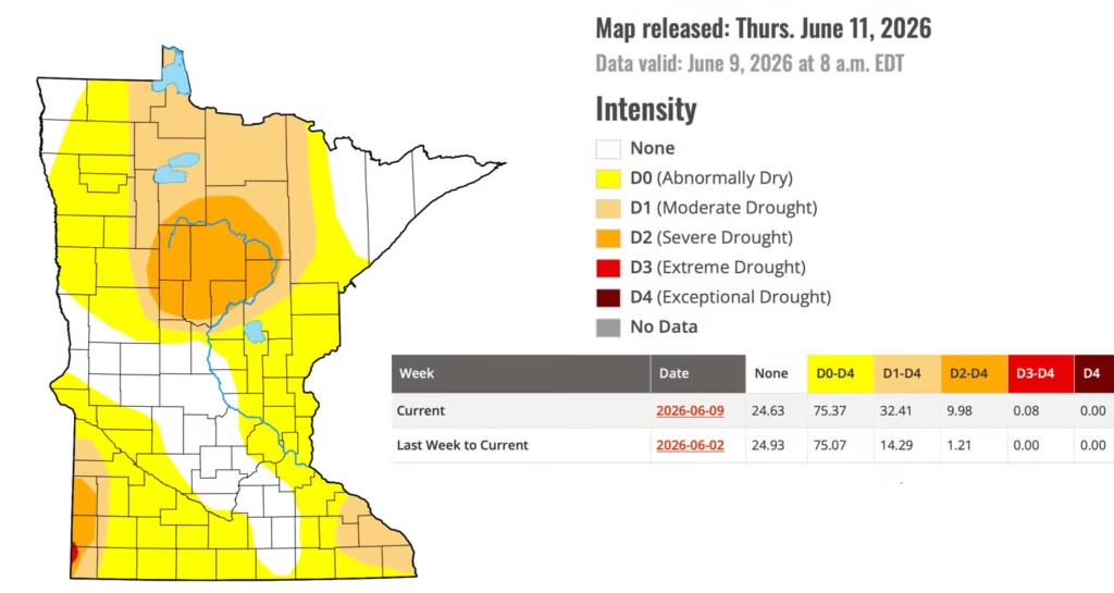
Severe drought expanded from just 1 percent of the state in the southwest corner of Minnesota to now a tenth of the state, including southwest Minnesota and the stubborn drought area of north central Minnesota. We’ve also now seen the “extreme drought” category appear in the far northwest corner of Rock County. This is the first time we’ve had extreme drought in Minnesota since March 2024.
The Twin Cities metro area is considered just “abnormally dry.” Despite some hit-and-miss rains this week, MSP Airport is behind by 0.71 inches for just these first 12 days of June alone. We’ve seen roughly half of normal rainfall.
We’re also carrying over a 1.67-inch deficit from May. So, since May 1, MSP Airport is behind by 2.38 inches, or roughly 44 percent.
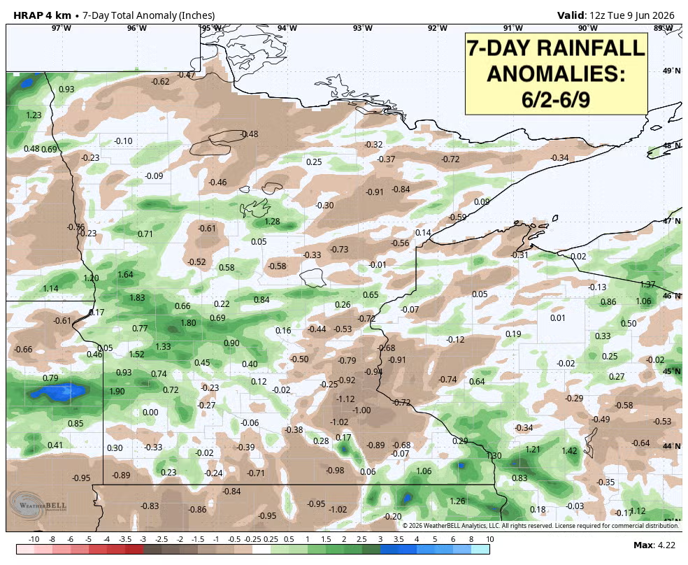
To give you an idea of what we’re up against, take a look at seven-day rainfall totals for roughly Hennepin and Ramsey counties:
This time of year, we need at least 1 inch of rainfall per week to keep up with normal. Anything less adds to our deficits. So, while we’ve had some nice, hit-and-miss rains this past week, for most locations it falls short of the 1-inch mark. To be sure, there are several spots that received more than 1 inch, but only nominally so. Keep in mind the Twin Cities metro isn’t in drought like other parts of the state.
For this latest drought monitor, the only part of the state that saw surplus weekly rainfall was west central Minnesota, which already was doing just fine on soil moisture and rainfall totals.
That’s the story of drought and persistent weather patterns. The wet areas keep getting wet and the dry areas keep getting dry until something changes.
One of the big factors in drought monitoring isn’t just what you’re measuring in a rain gauge but the soil moisture content. Surface soils dry out quickly this time of year with the strong sun and warm temperatures. It tells the same story as the spotty rain reports:
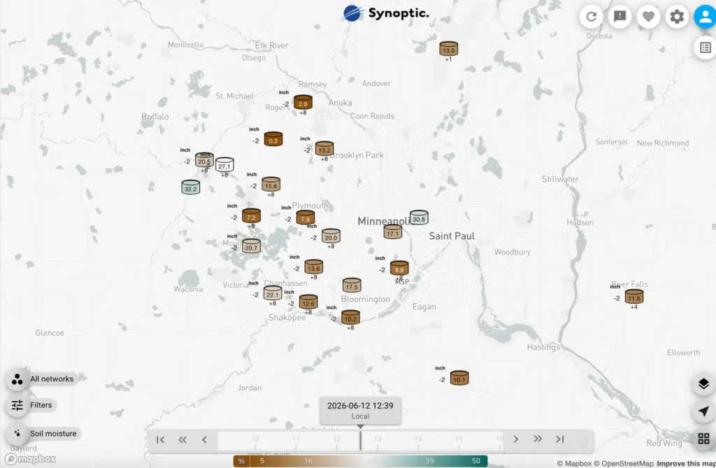
Places that have gotten good rains are doing okay, with roughly 30 percent considered adequate soil moisture. A few locations are at 20 to 30 percent in the surface soils, but others, like MSP Airport, are at just about 9 percent.
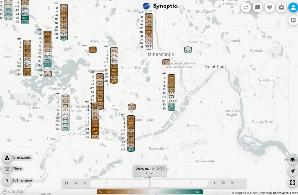
When you dig down into the depths, you can find moisture from the early spring and fall. You have to go down 2 feet to get to good moisture content at MSP:
How about looking ahead?
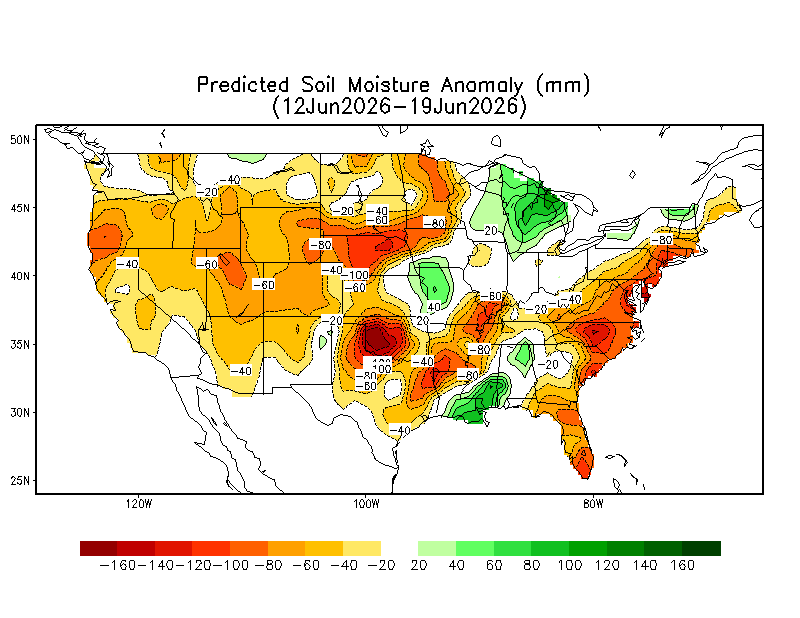
In the next seven days, this cooler, drier air, while more comfortable, will likely dry soils out even more. The forecast is for soils to dry out substantially in the next seven days, especially in north central and southern Minnesota.
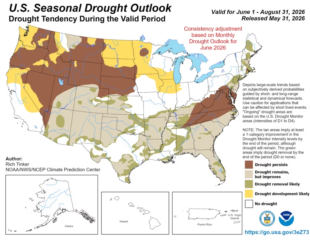
The seasonal drought outlook for the summer shows most of Minnesota likely to develop drought. That is not good news, obviously.
We’ve been in a vicious cycle of frequent drought really since 2020. Since 2020, there’s been drought in Minnesota 80 percent of the time. Compare that to the 2014-2020 period, when drought was much less frequent.
While I know it’s an unpopular idea to cheer on muggy dew points, they’re essential for producing thunderstorms, and thunderstorms are where roughly 70 percent of our growing-season rainfall comes from. Yes, that includes severe weather sometimes, but that’s the name of the game here in a volatile part of the climate world.