


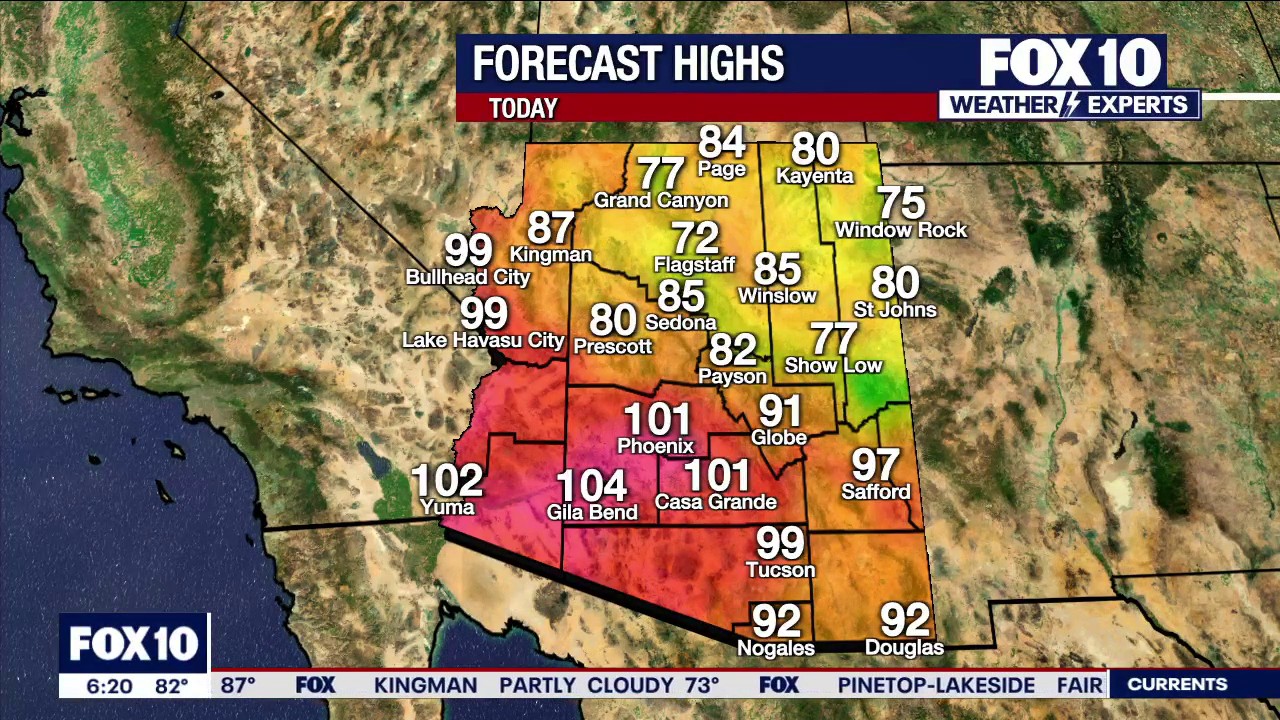
Arizona is set for a cooler and increasingly unsettled week, with temperatures in Phoenix expected to fall from 101F (38C) on Monday to the mid-to-high 90s by Thursday as rain chances build across the state.
The change is being driven by an area of low pressure moving east from Southern California. A trough will push inland from Tuesday into Wednesday, while a smaller disturbance is expected to pass across Arizona between Tuesday and Thursday.
The developing weather pattern will draw late-season monsoonal moisture into the region, bringing the greatest risk of thunderstorms to eastern and south-eastern Arizona. Some storms could spread towards Phoenix by late Wednesday or Thursday.
Arizona weather forecast brings cooler temperatures and rain chances
Forecast highs are expected to reach 101F (38C) in Phoenix on Monday, 99F (37C) on Tuesday and 97F (36C) on Wednesday. Depending on the timing and coverage of storms, Thursday’s temperatures could remain in the upper 90s or fall into the low to mid-90s.
Cloud cover will also increase through the week. Phoenix is expected to see partly sunny skies on Monday, mostly sunny conditions on Tuesday, followed by partly to mostly cloudy weather on Wednesday and Thursday.
Forecasters are also watching Tropical Storms Odalys and Polo in the eastern Pacific. The National Hurricane Center said both systems could strengthen, with Polo posing a potential risk to Mexico’s western coast.
Any tropical moisture reaching Arizona is not expected until late in the weekend or next week, and the eventual impact remains uncertain. Officials will continue to monitor the storms as their tracks and strength become clearer.
Residents are being urged to remain cautious around thunderstorms, which can bring sudden heavy rain, strong winds, dust and flash flooding. Drivers should never attempt to cross a flooded road, while people caught near rising water should move to higher ground.
