


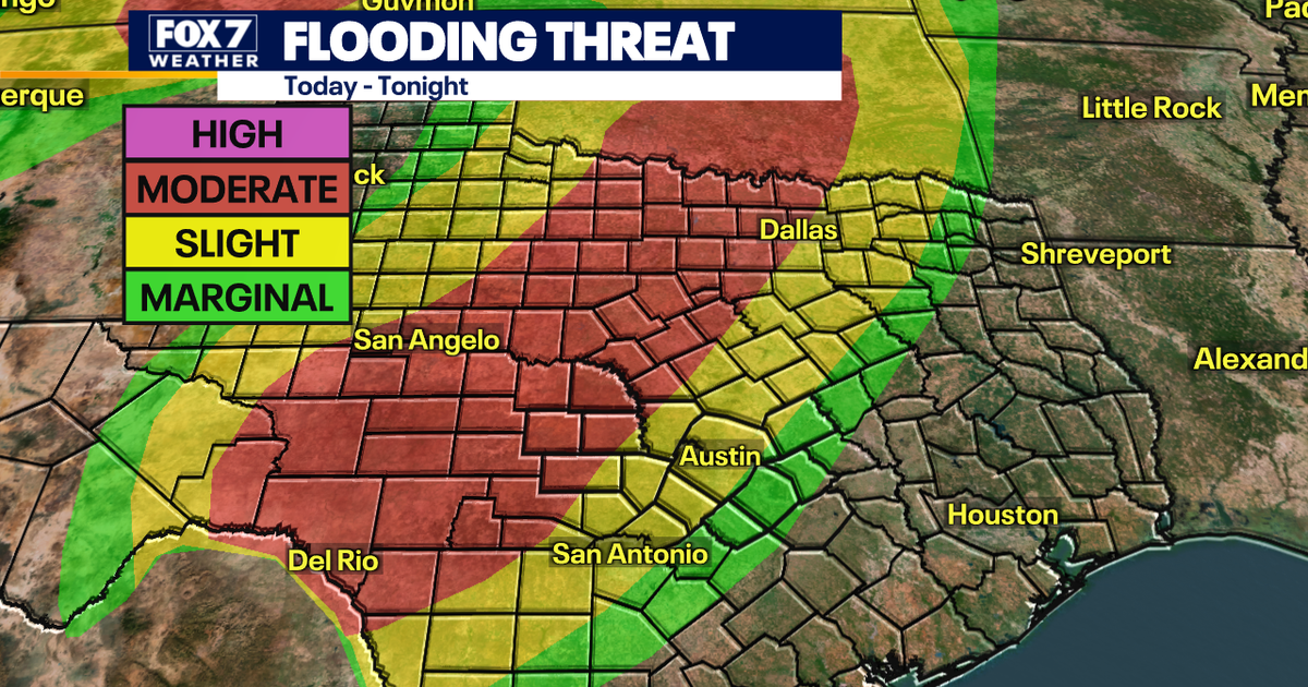
A Flood Watch has been issued across much of Central Texas as Austin faces several rounds of heavy rain and thunderstorms, with the greatest risk of flooding expected on Thursday, October 1.
The National Weather Service in Austin-San Antonio said the watch would run from Wednesday evening, September 30, until Friday evening, October 2. Forecasters warned that intense rainfall could cause dangerous flash flooding in parts of the region.
A slow-moving front is expected to interact with tropical moisture already in place, creating conditions favourable for repeated downpours. A developing low-pressure system will help drive storms along the boundary over the coming days.
Heavy rain and storms expected in Austin
The first storms are forecast to arrive early on Thursday, bringing scattered thunderstorms, moderate rain and lightning. A second, more widespread round is expected later in the day and into Thursday night.
That later spell could bring torrential rain, strong thunderstorms, gusty winds and small hail, although flooding remains the main concern. The National Weather Service said some storms could become severe, with damaging winds and hail possible in isolated areas.
Rainfall totals of between 2in and 4in are possible across the area, while isolated locations could receive 4in to 6in. Forecasters said the location of the heaviest falls remained uncertain, increasing the risk that some communities could be affected by particularly intense or prolonged rainfall.
Central Texas is under a Level 3, or moderate, risk of excessive rainfall for Thursday. The threat includes street flooding, flash flooding and river flooding, particularly where storms repeatedly track over the same areas.
Residents in and around Austin are being urged to monitor weather warnings and avoid driving through flooded roads. The National Weather Service advises people never to cross a flooded roadway, as even shallow, fast-moving water can sweep vehicles away.
Rain and thunderstorms are expected to continue into Friday, with cooler conditions likely behind the front. Further showers could linger through the weekend before the weather gradually becomes drier next week.
