


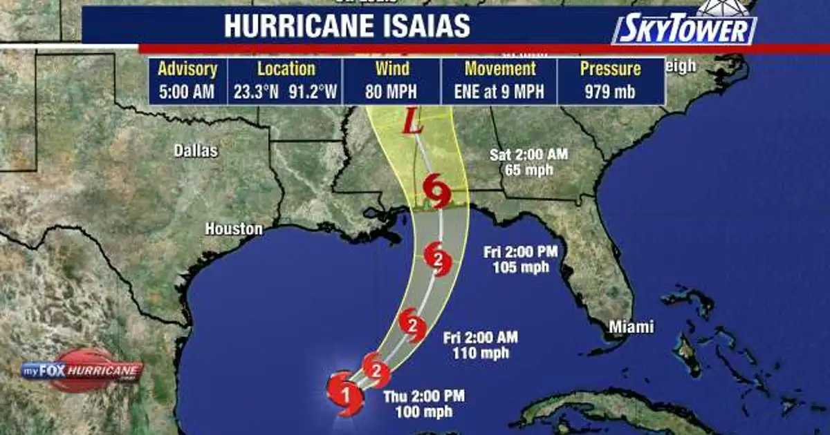
Hurricane Isaias is strengthening over the Gulf of Mexico and is expected to bring dangerous winds, heavy rain and life-threatening storm surge to the northern Gulf Coast when it reaches land late on Friday or early Saturday.
The National Hurricane Center said early on Thursday that the storm had maximum sustained winds of about 80mph and was moving east-north-east at 9mph. It was positioned roughly 170 miles north-west of Progreso, Mexico, and 420 miles south-south-west of the mouth of the Mississippi River.
Further strengthening is expected as Isaias passes north of the Yucatán Peninsula. Forecasters expect the system to turn towards the north-east later on Thursday before moving north on Friday and approaching the coast overnight.
Hurricane Isaias warnings across the Gulf Coast
A hurricane warning is in force from Ocean Springs, Mississippi, to the Bay and Gulf county line in Florida. A storm surge warning stretches from the mouth of the Mississippi River to the Steinhatchee River in Florida.
Tropical-storm warnings are also in effect for parts of the Louisiana coast and areas east of the Florida Panhandle warning zone. The most likely landfall area remains the coast around the Florida Panhandle, southern Alabama or southern Mississippi.
Hurricane-force winds extend up to 15 miles from the centre of the storm, while tropical-storm-force winds reach as far as 90 miles. The National Hurricane Center said Isaias was expected to remain a strong hurricane as it neared the coast, despite increasing wind shear likely to disrupt its structure.
Forecasters are warning of between 3in and 7in of rain across the central Gulf Coast, with isolated totals of up to 10in from south-eastern Louisiana to the Florida Panhandle. Parts of the wider South and Tennessee Valley could receive 1in to 3in.
Higher-than-normal tides are expected around Florida’s Tampa Bay area on Friday, reaching up to 3ft above normal high tide. The storm surge threat will depend on the eventual track, intensity and timing of landfall.
Outer rain bands could also bring severe thunderstorms and tornadoes to northern Florida, Georgia and Alabama as the hurricane interacts with drier air and begins to change form over land.
Officials have not yet confirmed the precise peak surge levels for individual coastal communities. The timing and location of any flash or river flooding will also depend on local rainfall totals during the weekend.
