


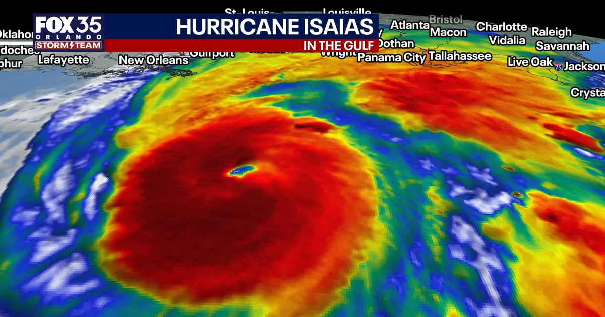
Hurricane Isaias is intensifying over the Gulf of Mexico and could briefly reach Category 3 strength before making landfall on the northern Gulf Coast, forecasters have warned.
The storm had maximum sustained winds of 110mph as it moved north-north-east at about 15mph, with the National Hurricane Center expecting winds to rise to 120mph later on Friday.
Isaias is forecast to come ashore near the Pensacola-Mobile area on Friday night or early Saturday, bringing a dangerous combination of hurricane-force winds, storm surge and flooding rainfall.
Hurricane Isaias threatens Gulf Coast
Very warm water in the central Gulf is expected to support further strengthening in the hours before landfall. However, increasing wind shear in the upper atmosphere should weaken the system to a high-end Category 2 hurricane before it reaches the coast.
The National Hurricane Center has cautioned that even a delay of six hours in the arrival of the stronger wind shear could allow a significantly more powerful storm to reach land.
Storm surge is expected across a wide stretch of the northern and eastern Gulf Coast. Water levels could rise by one to two feet around Tampa Bay, while two to four feet of surge is possible along Florida’s Big Bend between Cedar Key and Horseshoe Beach.
The greatest surge threat is between Panama City Beach and Mobile Bay, where levels could exceed seven feet. Life-threatening inundation is also possible from the mouth of the Mississippi River eastwards towards Florida’s Big Bend.
Hurricane warnings are in force across southern Mississippi, southern Alabama and the western Florida Panhandle. Communities near and east of the landfall zone face the risk of widespread power cuts, damaging winds, heavy rain and flooding.
The storm’s eastern side could also produce tropical tornadoes from Friday night into Saturday, while heavy rainfall spreads across much of the south-eastern United States. The National Hurricane Center said flash flooding, urban flooding and river flooding were possible through the weekend.
In Central Florida, the most serious direct effects are expected to remain to the north-west of the region. Forecasters are warning of scattered to numerous thunderstorms, occasional strong gusts and localised flooding through Sunday.
Conditions are expected to become drier early next week as a weak front arrives on Monday. Isaias is forecast to weaken as it moves north-eastwards by Sunday, with the remnants dissipating by early Monday.
