


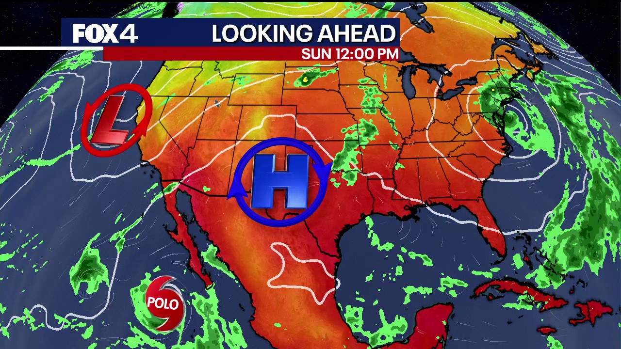
Dallas and the wider North Texas region are facing a sharp change in weather this week, with tropical moisture expected to bring several rounds of heavy rain and a risk of flooding from Wednesday, September 30, through Friday, October 2.
The unsettled spell should also bring relief from the prolonged heat. Temperatures in the Dallas-Fort Worth area are forecast to fall from the 90s into the 80s by Thursday and Friday, while overnight lows ease into the upper 60s.
Heavy rain threat for North Texas
Before the wetter pattern arrives, Tuesday is expected to remain warm, with only a limited chance of showers. Rainfall coverage is likely to be greatest west and north-west of the metropolitan area, although isolated storms could bring gusty winds, frequent lightning and small hail.
The main change is expected from midweek, as high pressure weakens and an upper-air trough draws moisture northwards from the eastern Pacific. Forecasters are monitoring moisture associated with Hurricane Polo, which has been moving across the Pacific towards Baja California.
There is a 50% to 60% chance of rain on successive days from Wednesday onwards. Widespread totals of between 1 and 2 inches are possible across the region, with isolated locations potentially receiving 2 to 4 inches or more.
The National Weather Service has warned that the combination of repeated downpours and slow-moving storm activity could produce localised flooding. Although North Texas soils have been unusually dry, intense rainfall in a short period could still overwhelm drainage systems and cause problems on roads and in low-lying areas.
Heat eases after prolonged summer spell
Temperatures are expected to remain in the low 90s on Wednesday before dropping more decisively on Thursday and Friday. Cloud cover and rain will help bring afternoon readings into the 80s, ending the run of persistent 90-degree days.
The latest outlook from the National Weather Service’s Dallas-Fort Worth office points to a return to a more active weather pattern, with much-needed rain and thunderstorms accompanying a move towards more seasonal temperatures.
People attending the State Fair of Texas should therefore expect a warm start to the week, but conditions are likely to become wetter and cooler as the week progresses. Forecasters continue to advise residents to monitor updates as the rainfall threat develops.
