


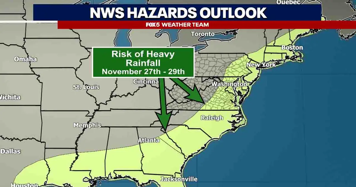
A developing Thanksgiving storm could disrupt travel across the eastern United States, bringing heavy rain, gusty winds and potentially accumulating snow to parts of the East Coast.
The Washington DC region is currently more likely to face wet and unsettled conditions than a winter storm, while colder areas farther north could see a mixture of snow and ice as the system develops.
The Climate Prediction Center is monitoring the entire East Coast for the possibility of an impactful storm, with a heavy-rain threat currently highlighted across the region.
Rain and delays expected around Washington DC
Forecast guidance indicates that conditions could begin to deteriorate during the busy Wednesday evening travel period, with rain continuing into Thanksgiving Day.
Temperatures in the District are expected to remain above freezing while the rain falls, although conditions could be chilly, with readings in the 40s and lower 50s.
For the immediate Washington metropolitan area, the main risks are periods of rain, potentially heavy, and travel delays rather than snowfall. The precise impact will depend on the storm’s track, strength and timing.
Conditions could be more complicated in mountainous areas. Colder air may linger across the highlands of West Virginia and the Maryland Panhandle, where rain could change to wintry precipitation or snow.
Interior Northeast faces risk of Thanksgiving snow
The forecast becomes more uncertain for northern Pennsylvania, upstate New York and interior and northern New England. Higher elevations in those areas could remain cold enough for accumulating snow, particularly if the storm follows a track close to the coast.
A process known as cold-air damming could trap colder air across parts of the interior Northeast, increasing the chance of wintry conditions. Under one possible scenario, some inland areas could experience a rare white Thanksgiving while the Interstate 95 corridor deals with heavy, cold rain.
However, the system remains far enough away for a relatively small shift in its track to change the outcome from cold rain to a wintry mix or snow.
Travel conditions across the East Coast are therefore expected to remain unsettled as Thanksgiving approaches. People planning to drive through mountainous areas or fly through major Northeast airports are likely to face the greatest risk of disruption if the storm strengthens or moves into a colder path.
Forecasters will continue to assess the storm’s development and the amount of cold air available across the interior Northeast in the days ahead.
