


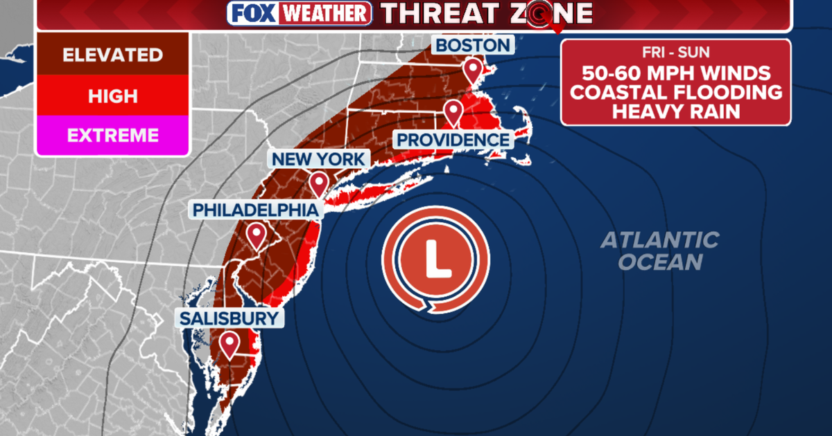
A powerful nor’easter is intensifying off the US north-east coast, bringing strong winds, dangerous surf and a serious threat of coastal flooding to more than 40 million people over the weekend.
The storm is expected to stall near Long Island, allowing onshore winds and exceptionally high tides to push water into vulnerable coastal communities from New York to Delaware. The National Weather Service has issued coastal flood warnings and advisories across parts of New York, New Jersey and Delaware, with some alerts remaining in force until Sunday, September 27. ([forecast.weather.gov](https://forecast.weather.gov/MapClick.php?FcstType=text&lat=40.6374&lg=en&lon=-73.9393&unit=0&utm_source=openai))
New York and Long Island face the greatest flooding risk
In New York City and along Long Island’s south shore, gusts of up to 40 to 50mph are expected to drive heavy waves towards beaches and low-lying waterfront areas.
Moderate, and locally major, coastal flooding is forecast during successive high-tide cycles. The south shore of Queens, Nassau County and south-western Suffolk County are among the areas considered most vulnerable, with water potentially reaching around 3½ft above ground level in exposed locations.
The National Weather Service has warned of coastal flooding in New York City through Sunday evening, alongside wind and high-surf advisories. Forecasts for the city indicate further rain and strong northerly winds on Saturday and Sunday, with gusts reaching about 45mph in some areas. ([forecast.weather.gov](https://forecast.weather.gov/MapClick.php?FcstType=text&lat=40.6925&lg=english&lon=-73.991&menu=1&utm_source=openai))
Water could spill across waterfront roads, while dune erosion and localised overwash are expected along exposed beaches. Authorities are warning that some roads may close and that vehicles left in low-lying areas could be damaged or stranded.
New Jersey and Delaware coastline battered by heavy surf
The Jersey Shore and Delaware beaches are facing some of the storm’s most severe marine conditions. Offshore waves of between 15ft and 18ft are expected to pound the coastline, causing substantial beach erosion and creating dangerous conditions for boats and swimmers.
High tides are expected to bring minor to major flooding along the New Jersey coast, the Delaware shoreline and the Delaware Bay. The greatest threats are forecast during Saturday morning and Saturday night, although flooding may continue into Sunday, particularly north of Atlantic City and in vulnerable tidal areas of Delaware.
The National Weather Service has warned that one to two feet of inundation could affect low-lying areas near shorelines and tidal waterways in parts of New Jersey and Delaware. It said widespread flooding could make some roads impassable, with minor damage possible to vulnerable structures. ([marine.weather.gov](https://marine.weather.gov/product.php?format=txt&glossary=0&issuedby=PHI&product=CFW&site=MQT&version=1&utm_source=openai))
Coastal flood warnings remain in place for parts of the region, while advisories cover inland bays and tidal rivers. Residents in affected areas have been urged to avoid flooded roads, as water levels can rise quickly and concealed hazards may be present.
Drier conditions expected around Washington
Washington DC and much of the surrounding metropolitan area are expected to escape the heaviest rain because the centre of the low-pressure system is tracking offshore.
Residents can nevertheless expect breezy conditions through the weekend, with occasional light showers possible. Minor to moderate tidal flooding is also forecast along vulnerable stretches of the tidal Potomac and Chesapeake Bay before water levels begin to fall early next week.
The combination of strong onshore winds, high astronomical tides and large waves is expected to keep coastal communities at risk even when rainfall eases. Officials have warned that the most exposed roads, beaches and bayside properties could continue to see impacts through Sunday.
