


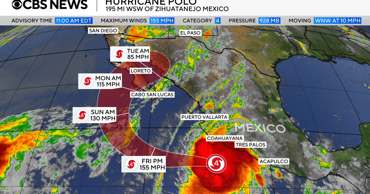
Hurricane Polo continued to fluctuate between Category 4 and Category 5 strength on Thursday as it moved away from Mexico’s south-western coast, while its outer rain bands threatened life-threatening flooding and mudslides.
The storm was expected to remain offshore, but forecasters warned that heavy rain would continue across parts of south-western Mexico. Polo’s centre was about 195 miles from Manzanillo, in Colima state, and was moving north-west at 10mph.
Hurricane-force winds extended up to 40 miles from the centre, with tropical-storm-force winds reaching about 125 miles. Some further strengthening was possible early on Friday before the system was expected to weaken from Friday night into Saturday.
Rainfall of between two and four inches was forecast in parts of Michoacán, Colima, Jalisco and Nayarit, with as much as six inches possible in isolated areas. Coastal parts of Jalisco and Guerrero could receive a further one to two inches.
The National Hurricane Center said the rain “may produce life-threatening flooding and mudslides, especially in areas of steep terrain”. Dangerous surf and rip currents were also expected along the south-western Mexican coast and parts of Baja California, with the conditions potentially contributing to flooding.
Mexico prepares for Hurricane Polo
Mexican authorities ordered evacuations, opened shelters and deployed military personnel in areas at risk. The government later cancelled all tropical-storm warnings and watches for south-western Mexico, although officials continued preparing for the storm’s effects.
Schools were suspended in Acapulco on Thursday, while shelters remained open across Guerrero. Officials in the state said they were working with local and national authorities to prepare for further impacts.
Authorities in Michoacán also cancelled classes through Friday in coastal municipalities and urged residents not to leave their homes unless necessary.
Although Polo remained well south of Baja California, forecasters said the peninsula could still be affected over the weekend. The storm’s centre was expected to continue moving away from Mexico’s south-western coastline.
Polo’s rapid intensification
Polo strengthened at an exceptional rate between Monday and Tuesday, with its winds rising from 45mph to 150mph in roughly 24 hours. Its maximum sustained winds later reached 180mph, well above the 157mph threshold for a Category 5 hurricane.
The storm’s central pressure made it the second-strongest hurricane recorded in the eastern Pacific, behind Hurricane Patricia in 2015. Its wind speeds equalled those of Hurricane Rick in 2009, placing it joint third for the region.
Unusually strong El Niño conditions have contributed to increased tropical cyclone activity in the Pacific this year, with warmer water, moist air and weaker wind shear helping storms to develop.
