


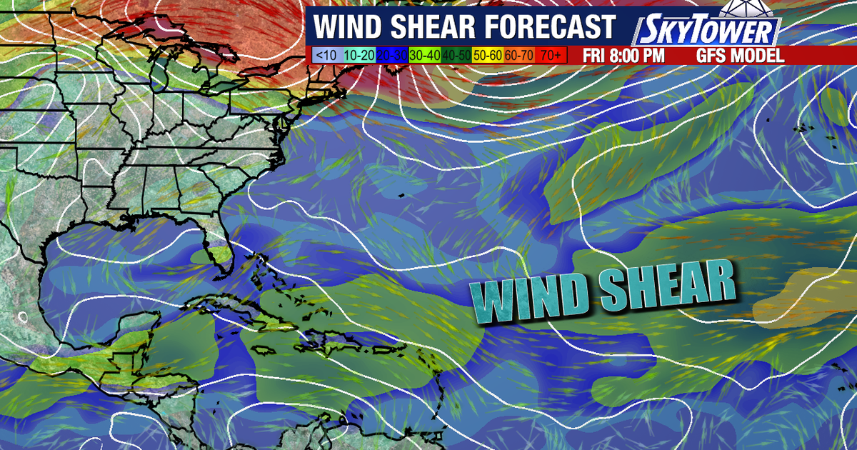
Atlantic tropical development is expected to remain limited in the coming days, with a lone disturbance given only a 30% chance of becoming a tropical system as strong El Niño conditions, hostile wind shear and Saharan dust suppress storm formation.
The disturbance is in the central subtropical Atlantic, about 600 miles east of Bermuda, where it is producing disorganised showers and thunderstorms. The US National Hurricane Center said conditions could become slightly more favourable in the next couple of days as the system moves slowly west to north-west. ([nhc.noaa.gov](https://www.nhc.noaa.gov/mobile/text/refresh/MIATWOAT%2Bhtml/260510_MIATWOAT.html?utm_source=openai))
Its chance of developing within 48 hours is 10%, rising to 30% over seven days. The National Hurricane Center said there were no tropical cyclones in the Atlantic on Wednesday, September 16. ([nhc.noaa.gov](https://www.nhc.noaa.gov/mobile/text/refresh/MIATWOAT%2Bhtml/260510_MIATWOAT.html?utm_source=openai))
El Niño and Saharan dust curb Atlantic storm formation
FOX 13 meteorologist Dave Osterberg said strong El Niño conditions were generating disruptive wind shear across the Atlantic’s main development region, while Saharan dust was adding to the unfavourable environment for tropical systems.
NOAA’s Climate Prediction Center said El Niño was strengthening, with a greater than 90% chance of a very strong event during the Northern Hemisphere autumn and winter of 2026-27. Forecasters cautioned that the atmospheric pattern could influence storm formation, but would not by itself rule out further tropical activity. ([cpc.ncep.noaa.gov](https://www.cpc.ncep.noaa.gov/products/analysis_monitoring/enso_advisory/ensodisc.html?os=..&utm_source=openai))
Mr Osterberg said computer forecast models suggested the Atlantic would remain relatively calm through at least next Monday. However, meteorologists cannot yet determine whether the subdued pattern will continue beyond that point and will keep monitoring the basin for any unexpected development.
