


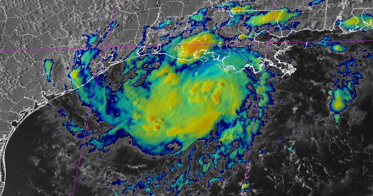
Tropical Storm Edouard has formed in the Gulf of America and is moving north-west towards the Texas coast, with Houston and surrounding areas warned to expect heavy rain, flooding and gusty winds.
The storm was positioned off the coast of Louisiana on Tuesday, September 1, as forecasters tracked its approach towards south-east Texas. Landfall is expected later on Tuesday.
Edouard has maximum sustained winds of between 39 and 73 miles per hour, the range used to classify a tropical storm. It is not forecast to strengthen into a hurricane before reaching the coast, which would require winds of at least 74 miles per hour.
Warnings issued for Texas coast
A Tropical Storm Warning is in force along the Texas coast from Port Bolivar to the Louisiana border, meaning tropical-storm-force winds are expected in the area.
A Storm Surge Watch has also been issued from High Island to Louisiana, while a Flood Watch covers much of south-east Texas, including the Houston metropolitan area.
The National Weather Service in Houston and Galveston said the storm’s main threat was rainfall, forecasting widespread totals of between three and five inches, with isolated amounts of six to nine inches possible. The highest totals are expected to the east of Interstate 45.
Officials warned that intense rain could overwhelm drainage systems and trigger flash flooding, particularly in urban areas. The National Oceanic and Atmospheric Administration’s Weather Prediction Center has placed much of the south-east Texas coast, including Houston, at a Level 2 risk of excessive rainfall for Tuesday and Wednesday.
Residents in low-lying areas and those travelling through flood-prone parts of the Houston region have been urged to monitor local forecasts and avoid driving through flooded roads.
Edouard forecast to make landfall on Tuesday
The National Hurricane Center said Edouard would continue moving north-west before reaching the upper Texas coast. Forecast guidance has indicated a likely landfall near the coast between Sabine Pass and High Island, although the precise location could still change.
In addition to the risk of flooding rain, coastal communities could see rising water levels, rough seas and strong wind gusts. Conditions are expected to deteriorate as the storm moves closer to land.
Forecasters said the system was likely to weaken after moving inland, but heavy rain could continue across south-east Texas into Wednesday, bringing a further risk of street flooding and isolated flash floods in and around Houston.
