


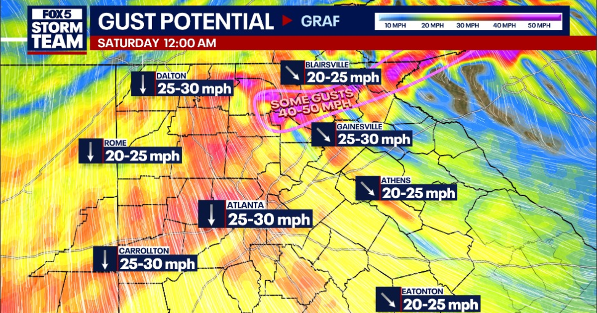
Atlanta is set for a fourth consecutive day of record or record-tying warmth on Friday, October 16, before a strong cold front brings gusty winds and a sharp fall in temperatures across north Georgia.
Temperatures in the city are expected to reach about 85F (29C), matching the daily record if the heat arrives before the front moves through. The National Weather Service is forecasting mostly sunny conditions, with winds strengthening during the afternoon. ([fox5atlanta.com](https://www.fox5atlanta.com/news/atlanta-eyes-4th-record-high-before-cold-front-brings-weekend-chill))
Cold front to bring strong winds
The front is expected to cross the region late on Friday, with only a small chance of an isolated shower during the evening. Winds will then turn north-westerly and become considerably stronger overnight.
Gusts of 30 to 35mph are possible across much of north Georgia, while exposed mountain ridges could see gusts above 40mph. The National Weather Service said the largely dry front would bring “crisp fall temperatures and gusty winds” to begin the weekend. ([marine.weather.gov](https://marine.weather.gov/product.php?format=txt&glossary=1&issuedby=FFC&product=AFD&site=REV&version=1&utm_source=openai))
The strongest winds could bring down branches and trees that have already been weakened by recent severe weather. Temperatures are expected to fall rapidly into the 40s and 50s Fahrenheit by early Saturday.
Chilly weekend ahead
Saturday will be sunny after some early cloud, but the high is forecast to remain around 65F (18C), well below Friday’s level. Winds of up to 30mph could make conditions feel colder.
Sunday morning will be colder still, with lows in the mid-40s Fahrenheit across Atlanta and the possibility of near-freezing temperatures in the higher mountains of north-east Georgia. The National Weather Service said the first readings below 35F this season could occur there. ([marine.weather.gov](https://marine.weather.gov/product.php?format=txt&glossary=1&issuedby=FFC&product=AFD&site=REV&version=1&utm_source=openai))
Daytime temperatures should stay in the 60s through Monday before a gradual recovery begins. Forecasts indicate a return to the low 70s on Tuesday, with warmer conditions building towards the mid-70s later in the week. ([forecast.weather.gov](https://forecast.weather.gov/MapClick.php?CityName=Atlanta&lat=33.7453&lon=-84.3796&site=FFC&state=GA&utm_source=openai))
