


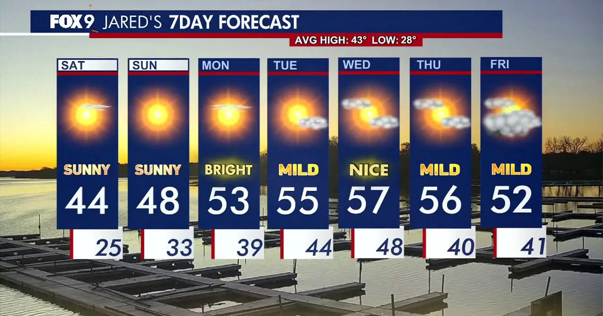
Minnesota is set for a bright but chilly Saturday, with clear skies replacing the early cold across Minneapolis and the wider Twin Cities area. Temperatures are expected to climb to about 44F (7C) by the afternoon, close to the seasonal average, with light winds and little chance of rain. ([forecast.weather.gov](https://forecast.weather.gov/product.php?format=TXT&glossary=0&issuedby=MPX&product=ZFP&site=NWS&version=1&utm_source=openai))
Some cloud is lingering over the Dakotas, but the National Weather Service expects limited weather activity across the region. Most of Minnesota should see sunshine and calm conditions through the day, although a few locations may remain in the upper 30s.
Warmer weather expected across Minnesota
The mild spell is expected to strengthen on Sunday, when the Twin Cities could reach 48F (9C). Forecast highs across Minnesota are generally expected to sit in the mid to upper 40s, with dry conditions continuing. ([marine.weather.gov](https://marine.weather.gov/product.php?format=TXT&glossary=0&issuedby=MPX&product=ZFP&site=HNX&version=1&utm_source=openai))
Overnight temperatures will fall back into the mid-20s in the Minneapolis area before the warmer trend resumes. The National Weather Service is forecasting a sunny Monday with highs in the lower 50s, followed by readings in the mid-50s on Tuesday and upper 50s on Wednesday. ([forecast.weather.gov](https://forecast.weather.gov/product.php?format=TXT&glossary=0&issuedby=MPX&product=ZFP&site=NWS&version=1&utm_source=openai))
For now, residents can expect a quiet weekend forecast: a crisp start, plenty of blue sky and little to no precipitation in the days ahead.
