


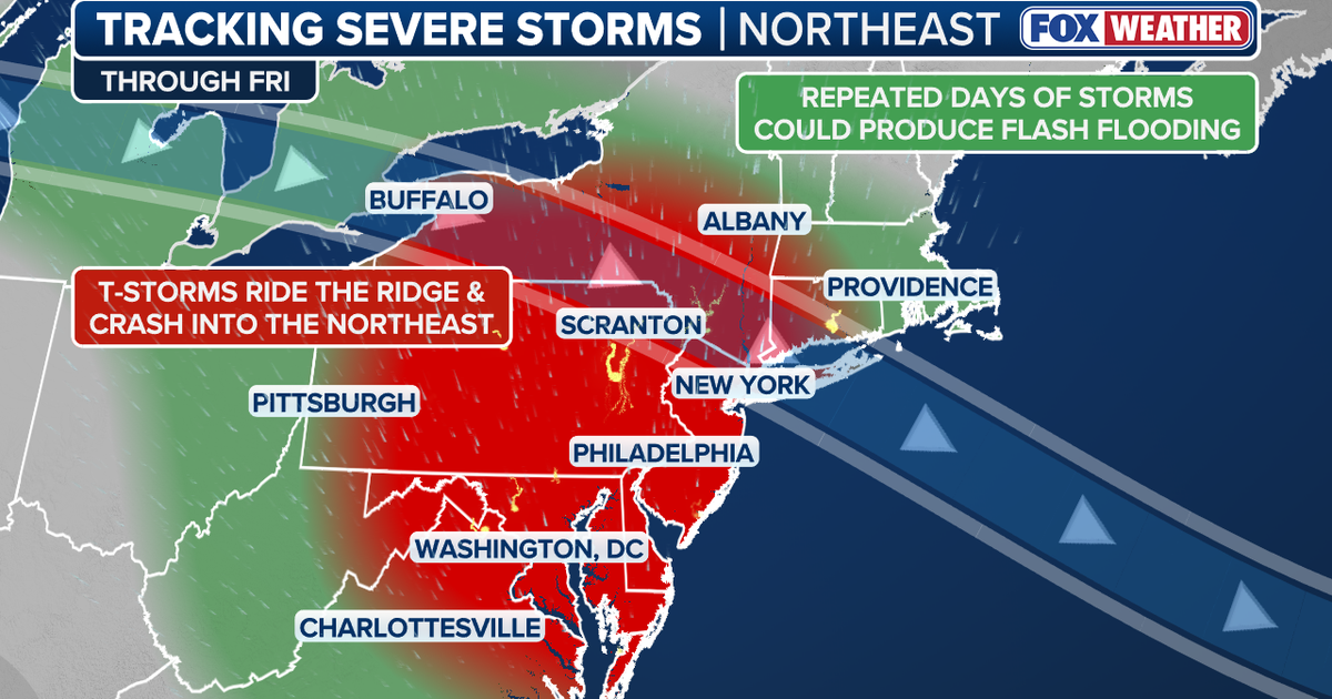
A spell of severe storms and flash flooding is set to continue across the north-east United States and Mid-Atlantic, with Philadelphia, New York City and Washington DC facing repeated threats from damaging winds, torrential rain, hail and lightning.
The FOX Forecast Centre said the strongest storms could also produce isolated tornadoes, while downpours may rapidly flood low-lying and poorly drained areas. The National Weather Service has warned of multiple rounds of thunderstorms across the Mid-Atlantic from Wednesday, 2 September, through Friday, 4 September, with damaging winds the principal concern. ([fox5dc.com](https://www.fox5dc.com/news/severe-storms-flash-flooding-northeast-forecast-timeline-dc-virginia-maryland))
Severe storms move through Pennsylvania and New York
Storms crossed Pennsylvania, New Jersey and New York on Tuesday, bringing heavy rain, power cuts and damaging gusts. FOX Weather reported winds reaching 70mph in parts of Delaware, Pennsylvania and New Jersey.
Repeated storms also triggered flash-flood warnings in eastern Pennsylvania, as cells moved over the same areas and increased the risk of rapid flooding. The National Weather Service recorded a flash-flood warning covering parts of north-east New Jersey and Staten Island on Tuesday evening. ([fox5dc.com](https://www.fox5dc.com/news/severe-storms-flash-flooding-northeast-forecast-timeline-dc-virginia-maryland))
New York City remains exposed to further heavy rainfall on Wednesday. The city has been placed in a level two out of four flash-flood risk area, meaning repeated downpours could overwhelm drainage systems, flood roads and affect urban areas.
The greatest potential for damaging wind reports and power outages during the current unsettled period is expected on Wednesday, with large hail and one or two tornadoes possible in the most powerful thunderstorms.
Washington DC comes into focus
The threat is expected to shift south towards Washington DC and other parts of the Mid-Atlantic on Thursday, 3 September. Storms may form along boundaries left behind by earlier rain and thunderstorms, with damaging wind gusts again the main hazard.
The National Weather Service office serving Baltimore and Washington said several rounds of thunderstorms, some potentially severe, were likely across the region from Wednesday through Friday. It said thunderstorms could continue into Thursday morning, followed by further activity later in the day. ([preview-forecast.weather.gov](https://preview-forecast.weather.gov/product.php?format=TXT&glossary=1&issuedby=LWX&product=AFD&site=NWS&version=1&utm_source=openai))
Further storms remain possible on Friday, 4 September, as the wider weather pattern persists along the East Coast. The focus may then move farther south into the Carolinas, although forecasters caution that the timing and location of the most dangerous weather could still change.
Residents across the affected states have been advised to monitor updated forecasts and keep more than one method of receiving emergency alerts. People should move indoors as soon as thunder is heard and avoid driving through flooded roads, while strong gusts may bring down trees and power lines even away from the heaviest rain.
