


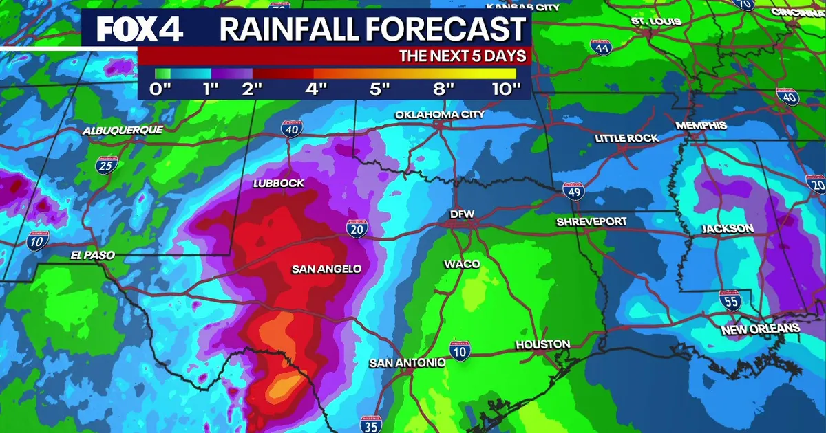
Dallas-Fort Worth is set for another warm day before rain moves into North Texas and a stronger cold front brings a sharp change in conditions early next week.
Temperatures are expected to reach about 83F (28C) on Wednesday, October 28, with south-easterly winds of 10 to 15mph. Morning lows will remain in the mid to upper 60s, accompanied by higher humidity across the Metroplex.
The National Weather Service said isolated showers or thunderstorms could develop on Wednesday afternoon and evening, although the chance of rain is only around 10 per cent and mainly affects areas south and south-east of Dallas-Fort Worth.
Most of the region is expected to stay dry through Thursday, with above-average temperatures continuing. The weather service’s latest forecast also puts the chance of isolated showers and storms near and south of Interstate 20 at around 20 per cent. ([1weather.onelouder.com](https://1weather.onelouder.com/afd/product.php?format=TXT&glossary=1&issuedby=FWD&product=AFD&site=NWS&version=34&utm_source=openai))
Rain chances rise before the cold front
Rain chances will increase from Friday afternoon, when about 40 per cent of the area could see showers or thunderstorms. The unsettled weather is expected to continue through at least the first half of Saturday, with daytime temperatures mainly in the 70s.
Rain should ease late on Saturday, allowing conditions to turn drier during the evening. Forecasters expect most Dallas neighbourhoods to remain suitable for trick-or-treating, although showers could linger east of the city into the early evening.
Sunday, November 1, should bring a quieter and largely rain-free interval, although cloud cover will remain. Clocks in the United States will also go back by one hour that weekend as daylight saving time ends.
The main shift is expected on Monday and Tuesday, when a stronger weather system moves towards North Texas. Rain and thunderstorms are forecast to return as the associated cold front approaches. ([forecast.weather.gov](https://forecast.weather.gov/product.php?format=ci&glossary=1&issuedby=FWD&product=AFD&site=STO&version=4&utm_source=openai))
Once the front passes, winds will turn northerly and temperatures are expected to fall significantly by Wednesday, November 4. The National Weather Service said forecast guidance was increasingly indicating a stronger autumn front could pass through the area on Monday or Tuesday. ([forecast.weather.gov](https://forecast.weather.gov/product.php?format=ci&glossary=1&issuedby=FWD&product=AFD&site=STO&version=4&utm_source=openai))
