


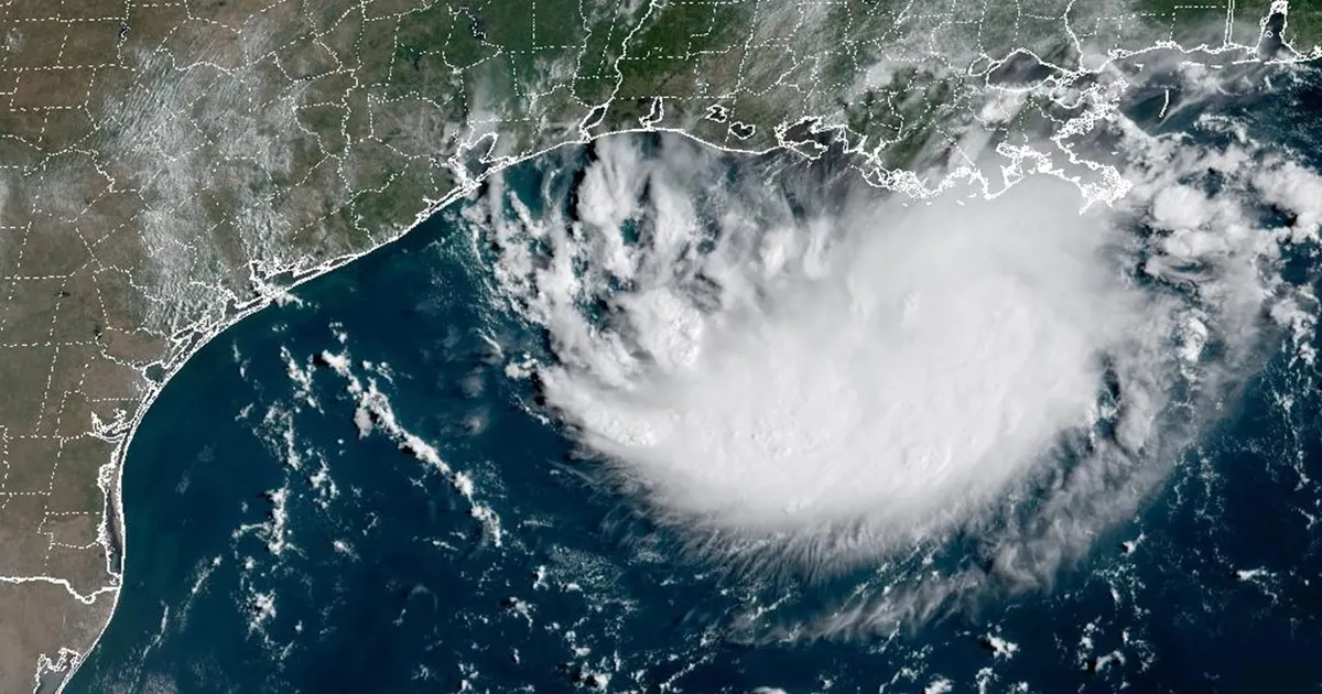
A tropical depression has formed in the northern Gulf, prompting a tropical storm warning for parts of the Texas and Louisiana coasts and raising the risk of heavy rain and flash flooding around Houston.
The system, designated Tropical Depression Five by the US National Hurricane Center, was about 230 miles (370km) south-east of Port Arthur, Texas, on Monday afternoon. It had maximum sustained winds of 35mph and was moving west-north-west at about 5mph. ([nhc.noaa.gov](https://www.nhc.noaa.gov/text/refresh/MIATCPAT5%2Bshtml/311751.shtml?utm_source=openai))
It is the same disturbance previously monitored as Invest 97L and Potential Tropical Cyclone Five. If its winds strengthen to at least 39mph, it will become a tropical storm and be named Edouard.
Warnings issued for Texas and Louisiana
A tropical storm warning is in force from Port Bolivar in Texas to the Vermilion/Cameron Parish line in Louisiana. The National Hurricane Center said tropical storm conditions could reach the warning area within 24 to 36 hours. ([nhc.noaa.gov](https://www.nhc.noaa.gov/text/refresh/MIATCPAT5%2Bshtml/311751.shtml?utm_source=openai))
The depression is forecast to continue towards the Texas coast, with the centre expected to move inland near the upper Texas coast. The National Hurricane Center said tropical-storm-force winds were expected along parts of the coast on Tuesday, while coastal flooding could also affect low-lying areas. ([nhc.noaa.gov](https://www.nhc.noaa.gov/mobile/text/refresh/MIATCDAT5%2Bhtml/311456.shtml?utm_source=openai))
Forecasters expect the system to produce between 3in and 6in of rain across parts of the upper Texas coast and east-central Texas, with isolated totals of up to 9in. South-western Louisiana could receive between 2in and 3in.
The National Weather Service said the heaviest rainfall could lead to flash flooding, particularly in urban and low-lying areas. The Weather Prediction Center has placed much of south-east Texas, including the Houston area, under a level-two-of-four risk for excessive rainfall on Tuesday. ([nhc.noaa.gov](https://www.nhc.noaa.gov/text/refresh/MIATCPAT5%2Bshtml/311751.shtml?utm_source=openai))
Residents in the affected areas have been urged to monitor updates from local weather authorities as the depression strengthens and moves closer to the coast.
