


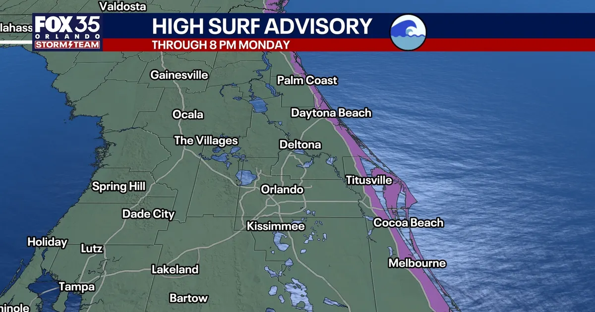
Strong winds are set to bring rough surf, dangerous rip currents and coastal flooding to parts of central Florida this weekend, while Orlando faces scattered showers and gusts of up to 30mph.
The National Weather Service in Melbourne has warned of a prolonged spell of hazardous beach and boating conditions along the east-central Florida coast, with residents advised to stay out of the ocean. ([marine.weather.gov](https://marine.weather.gov/product.php?format=CI&glossary=0&issuedby=MLB&product=AFD&site=MFR&version=1&utm_source=openai))
Dangerous surf and coastal flooding expected
A Coastal Flood Warning will come into effect from 2am on Sunday and remain in place until 8pm on Monday for vulnerable coastal areas. Forecasters say significant flooding is possible, particularly near low-lying roads, properties, the Intracoastal Waterway and the beaches. ([marine.weather.gov](https://marine.weather.gov/product.php?format=CI&glossary=1&issuedby=MLB&product=CFW&site=EWX&version=1&utm_source=openai))
A High Surf Advisory is also due to run through Monday evening, with breaking waves of between 6ft and 12ft expected in the surf zone. The National Weather Service said beach erosion and powerful rip currents would create dangerous swimming conditions. ([weather.gov](https://www.weather.gov/wwamap/wwatxtget.php?cwa=usa&wwa=all&utm_source=openai))
Marine conditions are expected to deteriorate as northeast winds strengthen. Seas offshore could reach 10ft to 15ft, with gale-force conditions forecast from Saturday evening into Monday. ([marine.weather.gov](https://marine.weather.gov/product.php?format=TXT&glossary=1&issuedby=MLB&product=AFD&site=MFR&version=2&utm_source=openai))
People heading to the coast have been urged to follow beach safety warnings and avoid entering the water. The weather service said driving through flooded roads or around barriers could be hazardous.
Orlando forecast remains warm with scattered showers
Across the Orlando area, a tight pressure gradient between high pressure over the eastern United States and lower pressure over the Atlantic will maintain a brisk easterly to north-easterly breeze.
Rain chances are expected to be about 50 per cent near the coast and 30 per cent inland on Saturday. Showers should be brief and fast-moving, although some could bring locally heavy rain and sudden gusts.
Temperatures will remain near seasonal levels, with highs of about 80F to 82F (27C to 28C) around Orlando. Coastal communities will be slightly cooler, while overnight temperatures are expected to fall into the 60s inland and remain near 70F along the shore.
The weather is expected to become drier next week as mid-level moisture decreases. Shower chances could fall to about 20 per cent, although periods of cloud and sunshine are likely to continue.
The National Hurricane Center said on Saturday that tropical cyclone formation was not expected in the North Atlantic, Caribbean Sea or Gulf of America during the following seven days. ([nhc.noaa.gov](https://www.nhc.noaa.gov/mobile/text/refresh/MIATWOAT%2Bhtml/301724_MIATWOAT.html?utm_source=openai))
