


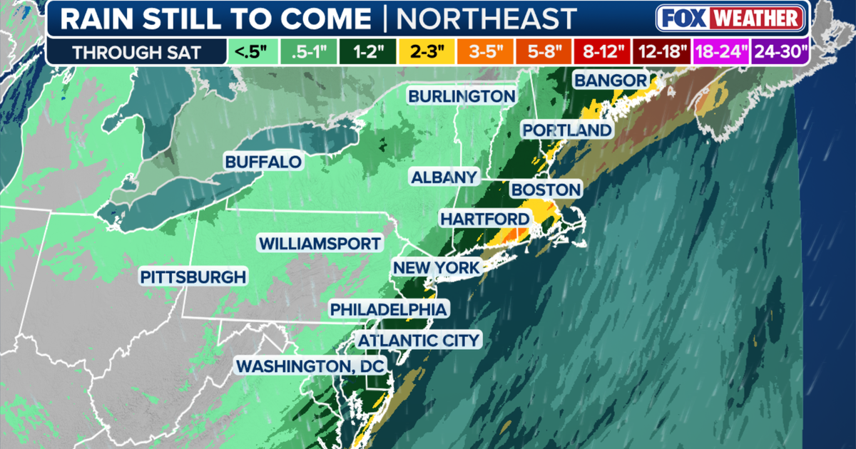
Heavy rain and thunderstorms disrupted the Friday morning commute across the New York City area as a slow-moving cold front drew unusually warm, humid air into the Tri-State region.
Temperatures reached about 67F (19C) in the early hours, more typical of late summer than November, while dense fog reduced visibility in parts of north-western New Jersey, New York and Connecticut.
The National Weather Service issued a flood advisory for parts of New York City, Nassau County and western Suffolk County until 9.15am, warning that a further 1 to 2 inches of rain could produce waterlogging in low-lying areas and on poorly drained roads. ([forecast.weather.gov](https://forecast.weather.gov/showsigwx.php?firewxzone=NYZ212&lat=40.6501&local_place1=New+York%2FJohn+F.+Kennedy+Intl+Airport+NY&lon=-73.7913&product1=Coastal+Flood+Warning&warncounty=NYC081&warnzone=NYZ178&utm_source=openai))
Heavy rain and thunderstorms move across the region
Storms intensified across central and southern New Jersey during the morning before moving north-east at between 25 and 30mph. The strongest cells brought frequent lightning, torrential downpours and gusty winds.
Forecasters said the combination of deep moisture and an approaching area of low pressure was likely to bring widespread heavy showers during the busiest part of the Friday commute, with driving conditions expected to deteriorate through midday.
The National Weather Service placed much of the region under a marginal risk of excessive rainfall, with the heaviest conditions expected across Long Island and south-eastern Connecticut. It warned that isolated flooding could develop in urban areas and locations with poor drainage. ([ready.noaa.gov](https://www.ready.noaa.gov/ready2-bin/state.pl?product=discuss&state=ny&utm_source=openai))
Rain was expected to become lighter and more scattered during the afternoon, although damp and unsettled conditions were forecast to continue into Saturday. Drier and cooler weather may return on Sunday, while temperatures are expected to remain slightly above average for early November. ([ready.noaa.gov](https://www.ready.noaa.gov/ready2-bin/state.pl?product=discuss&state=ny&utm_source=openai))
Rainfall recorded over the previous 24 hours included just under two-thirds of an inch in Newark, about one-third of an inch in East Hampton and roughly 0.2 inches in Central Park.
