


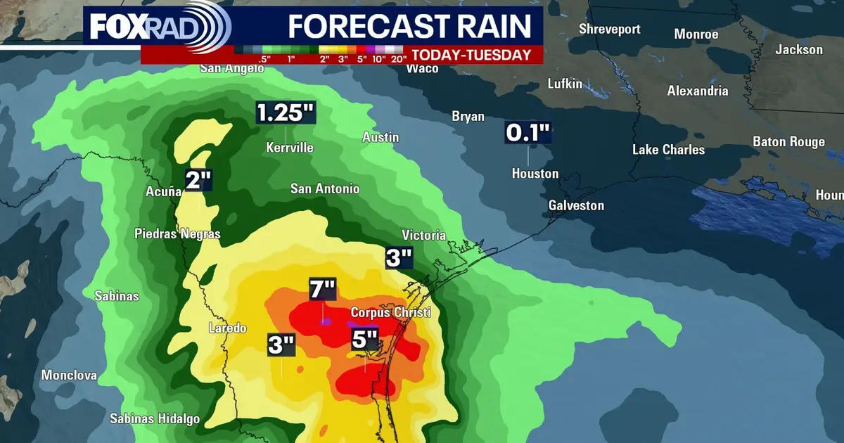
Houston is set for a grey and unsettled Sunday, with periods of rain, cooler temperatures and a heightened risk of flooding in parts of South Texas.
Temperatures across the city are expected to reach only the mid to upper 60s, while showers are likely to develop intermittently, particularly west and south of Houston. The National Weather Service said rainfall coverage would be greatest west of Interstate 45, with amounts generally lighter further east. ([forecast.weather.gov](https://forecast.weather.gov/product.php?format=txt&glossary=1&highlight=on&issuedby=HGX&product=AFD&site=NWS&version=1&utm_source=openai))
South Texas faces the greatest threat from heavier downpours, with a Level 2 out of 4 risk of street flooding in place for Sunday. The National Weather Service in Austin-San Antonio warned that embedded heavier showers and storms could produce periods of more intense rainfall and flooding. ([forecast.weather.gov](https://forecast.weather.gov/product.php?format=CI&highlight=on&issuedby=EWX&product=AFD&site=NWS&version=1&utm_source=openai))
Showers may linger into Monday
Further showers are possible on Monday as thick cloud keeps afternoon temperatures in the upper 60s to low 70s. Rain chances should ease on Tuesday, although cloudier conditions and a small chance of showers may remain.
Forecasters expect the next cold front to reach the Houston region late on Wednesday night or during the early hours of Thursday. It should bring drier and cooler weather for the remainder of the week. ([forecast.weather.gov](https://forecast.weather.gov/product.php?format=txt&glossary=1&highlight=on&issuedby=HGX&product=AFD&site=NWS&version=1&utm_source=openai))
Highs are forecast to reach the upper 70s on Wednesday and Thursday before falling to the low 70s on Friday and Saturday. Morning temperatures will dip into the 40s and 50s once the front has passed.
