


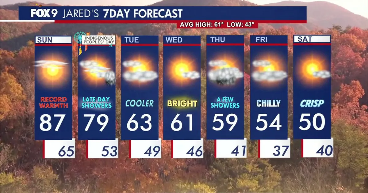
Minnesota is set to break a temperature record on Sunday as an unseasonably warm spell continues across the state before a cooler pattern moves in early next week.
Temperatures in the Minneapolis-St Paul area are forecast to reach 87F (31C), exceeding the previous daily record of 85F (29C). The National Weather Service also predicted a high of 87F for Minneapolis on Sunday. ([forecast.weather.gov](https://forecast.weather.gov/MapClick.php?lat=44.9817&lon=-93.2569&utm_source=openai))
A southerly breeze helped drive temperatures well above normal on Saturday and will keep conditions warm on Sunday. Winds are expected to remain noticeable, with gusts generally in the teens and potentially reaching about 20mph, although they should be lighter than on Saturday.
High cloud will spread across Minnesota through the afternoon, with skies becoming increasingly cloudy overnight as a front approaches from the north-west.
Cooler temperatures to follow in Minnesota
The front will begin lowering temperatures across the state on Monday. Forecasts for Minneapolis indicate a high of about 83F (28C), followed by a sharper drop to the mid-60s Fahrenheit on Tuesday. ([forecast.weather.gov](https://forecast.weather.gov/MapClick.php?lat=44.9817&lon=-93.2569&utm_source=openai))
Monday is expected to bring a mixture of cloud and sunshine, with showers developing first in north-western Minnesota. A few light showers may reach central parts of the state and the Twin Cities later in the day, although the National Weather Service said the chance of rain in Minneapolis remained relatively low. ([forecast.weather.gov](https://forecast.weather.gov/MapClick.php?lat=44.9817&lon=-93.2569&utm_source=openai))
Rainfall is not expected to be extensive, meaning outdoor plans should largely remain unaffected before the cooler air settles across Minnesota.
