


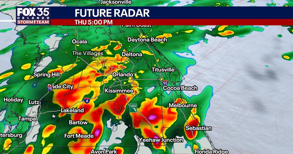
Central Florida is facing another day of heavy rain and thunderstorms, with widespread downpours and localised flooding expected across the Orlando area on Thursday, October 8.
The region remains trapped beneath a tropical air mass and a stalled frontal boundary, drawing moisture northwards from Hurricane Isaias in the Gulf of Mexico. Forecasters say rain is likely for much of the day, with the heaviest storms potentially developing south of Orlando during the afternoon and evening.
Rainfall chances are close to 90%, while some parts of Central Florida could receive a further 2 to 4in. Repeated downpours are expected to pose the greatest flooding risk, particularly in areas where several inches of rain have already fallen.
The National Weather Service in Melbourne has warned of a marginal risk of excessive rainfall across east Central Florida, saying that minor flooding could occur where multiple bands of heavy rain pass over the same location.
Temperatures are expected to remain in the low 80s in and around Orlando, although readings could reach the upper 80s further south where brief breaks in the cloud allow sunshine through.
More storms expected over the weekend
Conditions may ease slightly on Friday as the stalled front begins to lift northwards, but rain chances will remain between 60% and 80%. The area could see longer breaks between showers before another surge of tropical moisture arrives.
Saturday is expected to turn stormier, with widespread afternoon and evening thunderstorms and a further 1 to 3in of rain possible. Stronger storms could produce wind gusts of about 45mph, while southerly winds outside thunderstorms may reach 20 to 25mph.
Scattered showers and storms are likely to continue on Sunday, though increasing breaks in the cloud should allow temperatures to rise into the upper 80s and low 90s.
Hurricane Isaias strengthens in the Gulf
Hurricane Isaias became the first hurricane of the 2026 Atlantic season late on Wednesday night, after aircraft reconnaissance found maximum sustained winds of 75mph. By early Thursday, the National Hurricane Center reported that the storm had strengthened further, with winds of 80mph.
The hurricane is forecast to intensify over the very warm waters of the Gulf before reaching the northern Gulf Coast late on Friday or early on Saturday. The National Hurricane Center expects the greatest threat from hurricane-force winds across southern Mississippi, southern Alabama and the western Florida Panhandle.
Warnings are in place along parts of the Gulf Coast for damaging winds and life-threatening storm surge. Forecasters are also monitoring the risk of tropical tornadoes on the eastern side of the system, particularly from Friday night into Saturday.
Central Florida is not expected to receive the hurricane’s strongest direct impacts. The main threat for the Orlando region remains repeated heavy rain and thunderstorms through Saturday, with drier and more comfortable conditions expected to develop from Tuesday as a weak front moves through.
