


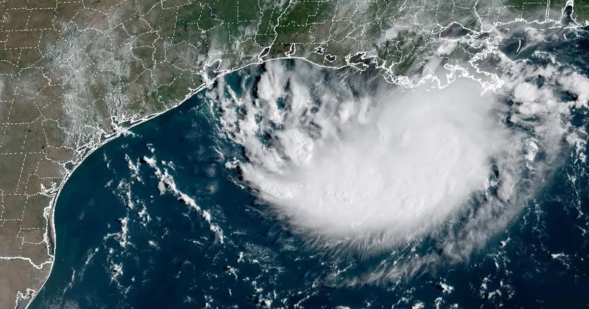
A tropical depression has formed in the Gulf of America, prompting a tropical storm warning and flood alerts along parts of the Texas and Louisiana coasts. Tropical Depression Five is expected to move towards the upper Texas coast on Tuesday, bringing heavy rain and a risk of flash flooding, including in the Houston area.
The National Hurricane Center said the system was centred about 110 miles south of Morgan City, Louisiana, at 1pm local time on Monday, August 31, 2026. It was moving west-north-west at about 5mph, with maximum sustained winds of 35mph. ([nhc.noaa.gov](https://www.nhc.noaa.gov/?utm_source=openai))
The depression developed from the disturbance previously monitored as Invest 97L and Potential Tropical Cyclone Five. If its winds strengthen to at least 39mph, it will become Tropical Storm Edouard. ([fox7austin.com](https://www.fox7austin.com/weather/potential-tropical-cyclone-5-gulf-tropical-storm))
Warnings issued along the Texas and Louisiana coast
A tropical storm warning is in force from Port Bolivar in Texas to the Vermilion-Cameron parish line in Louisiana, covering coastal areas that could experience tropical-storm conditions.
The National Weather Service has also issued a flood watch for parts of south-east Texas, including locations around Houston. At some coastal sites, a coastal flood warning is due to come into force on Tuesday. ([nhc.noaa.gov](https://www.nhc.noaa.gov/mobile/text/refresh/MIATCVAT5%2Bhtml/311752.shtml?utm_source=openai))
The depression is forecast to continue north-west towards the Texas coast and could strengthen into a tropical storm before making landfall on Tuesday morning or Tuesday night. The National Hurricane Center said the system remains relatively poorly organised, but conditions could still deteriorate along the coast. ([nhc.noaa.gov](https://www.nhc.noaa.gov/mobile/text/refresh/MIATCDAT5%2Bhtml/311456.shtml?utm_source=openai))
Heavy rain and flash-flood risk
Rainfall is expected to be the principal threat for Texas. The Weather Prediction Center has placed the upper Texas coast and far south-western Louisiana under a slight risk of excessive rainfall, with several inches possible in some areas.
Forecasters said deep tropical moisture and strengthening low-level winds could increase rainfall rates as the system approaches the coast. The outlook includes the Houston region and covers Tuesday into Wednesday. ([wpc.ncep.noaa.gov](https://www.wpc.ncep.noaa.gov/qpf/ero.php?day=2&opt=curr&source=post_page—————————&utm_source=openai))
The National Weather Service office serving Houston and Galveston warned that rain chances would increase on Tuesday, with some downpours likely to be locally heavy. Residents in areas covered by flood alerts have been urged to monitor updated forecasts and remain alert to rapidly rising water. ([marine.weather.gov](https://marine.weather.gov/product.php?format=CI&glossary=0&issuedby=HGX&product=AFD&site=LIX&version=1&utm_source=openai))
