


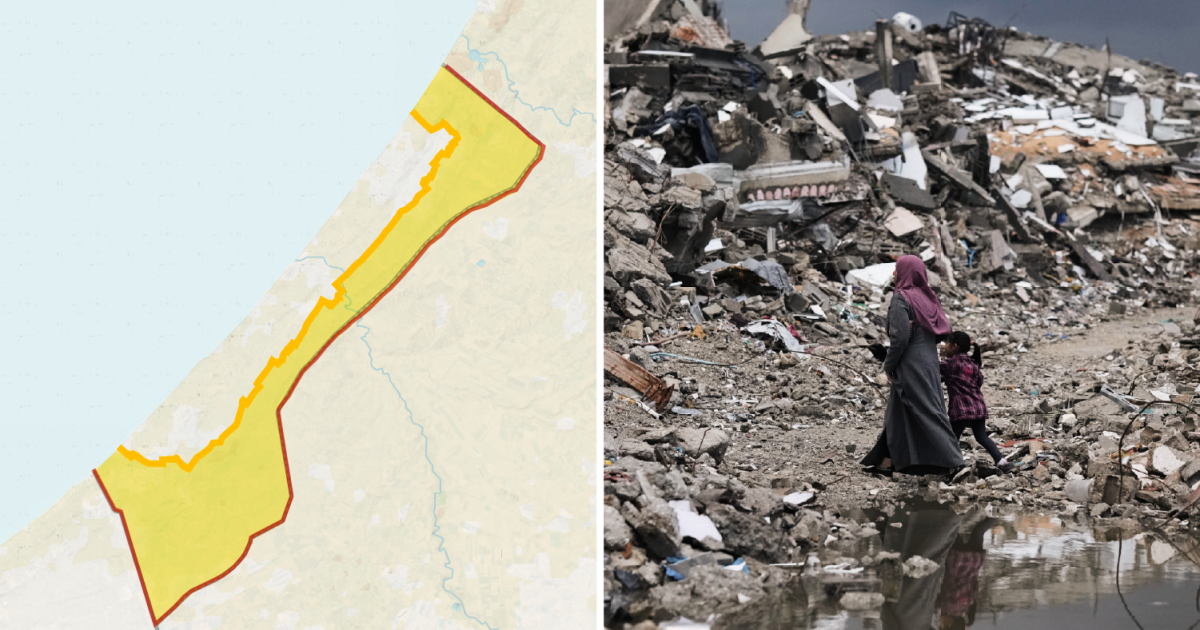
Israel has expanded its military control in Gaza despite a United States-brokered ceasefire, pushing Palestinians into an increasingly restricted area of the besieged territory. Nearly two-thirds of the Gaza Strip is now either under Israeli control or subject to access restrictions.
The latest reported advance came on Sunday in Shujayea, a neighbourhood in south-eastern Gaza City, where Israeli forces moved yellow concrete blocks dozens of metres west. Palestinian families were forced to leave as the area under military control widened.
The blocks mark the so-called Yellow Line, established under Donald Trump’s 20-point plan to end the war. Israeli forces were expected to withdraw further from their initial positions, but instead the line has repeatedly been moved into Palestinian areas.
“It’s not simply about where the ‘Yellow Line’ is today but where it can move next,” Ibrahim al-Khalili, reporting from Gaza City, said. “For families who have been repeatedly displaced in the past three years, the situation remains dire, and they have to make the impossible decision of where they can go.”
More than 90 per cent of Gaza’s population has been displaced during the war, which began after Hamas-led attacks on southern Israel on October 7 2023.
How Gaza’s restricted area has grown
Before the war, Palestinians lived throughout Gaza, a territory measuring about 365 square kilometres. Even then, access to parts of the Strip was limited by an Israeli buffer zone along the border fence, while Gaza had been under an Israeli land, air and sea blockade since 2007.
When the ceasefire began, Israeli forces were supposed to move to the Yellow Line within 24 hours. The line left Israel controlling about 53 per cent of Gaza, mostly in eastern border and farming areas, while Palestinians were confined to the remaining 47 per cent.
By October 2025, the population had fallen to about 2.1 million following two years of war. Those living in the Palestinian-controlled area faced a population density of roughly 12,000 people per square kilometre.
Since then, the yellow blocks have been moved westwards on repeated occasions, sometimes overnight. Satellite imagery has also recorded further demolitions in areas held by Israeli forces.
Forensic Architecture estimated that Israel controlled 58 per cent of Gaza by December. In March, aid agencies were given maps showing an additional “orange line”, beyond the Yellow Line, where humanitarian movements had to be coordinated with the Israeli military.
The United Nations Office for the Coordination of Humanitarian Affairs said restrictions now cover 65 per cent of the Strip. An Israeli estimate cited by a UN official put the area under Israeli control at about 70 per cent.
That leaves about 2.1 million people in roughly 35 per cent of Gaza, an area of about 128 square kilometres. Population density there has risen to around 16,000 people per square kilometre, leaving each person an average of about 61 square metres for housing, roads, schools, hospitals and farmland.
The remaining territory is already overcrowded, according to OCHA. About 950,000 people are living in displacement sites vulnerable to flooding during the rainy season, most of them in tents or other makeshift shelters.
Damage to infrastructure has further reduced the space available. UNOSAT found that 82 per cent of structures in Gaza had been damaged or destroyed, while the UN Food and Agriculture Organization said only 3 per cent of cropland was both undamaged and accessible.
Crossing towards the Yellow Line can also be deadly. Israel treats areas beyond it as a free-fire zone, and Palestinians approaching the line have been shot. Nearly 1,500 people have been killed across Gaza since the ceasefire was announced.
