


Australia needs common standards for assessing and managing flood risk, a senior coastal engineer has warned, as councils confront rising threats to homes, infrastructure and heritage sites.
Ryan Nguyen, a senior coastal engineer at professional services firm Hatch, said inconsistent planning tools and varying technical assumptions across Australia’s states made it harder for local authorities to explain, prioritise and defend decisions.
His comments come as about 1.4 million Australian properties are estimated to face some level of flood risk. The Insurance Council of Australia is calling for a $30.15 billion fund over ten years to support flood defences, strengthen vulnerable homes and fund buybacks or relocation where protection is not viable.
Mr Nguyen said councils should be able to compare risks using a shared evidence base rather than commissioning isolated studies that use different methods from one site to the next.
“It is about building an evidence base that supports clear choices, staged action, and honest communication about residual risk,” he said.
Flood risk planning under pressure
The issue is particularly pressing along Western Australia’s coastline, where local authorities are preparing for erosion, rising sea levels, tidal inundation and severe storms.
The City of Mandurah has backed a coastal hazard risk management and adaptation plan for its ocean-facing coastline between Roberts Point at Halls Head and the southern boundary at Clifton. The plan remains at draft stage and considers risks to beaches, parks, pathways and other community assets.
Proposed measures include tighter planning rules for areas vulnerable to erosion or inundation, alongside a dedicated coastal management fund. Mandurah is also part of the Peron-Naturaliste Partnership, a regional alliance of local governments working on coastal hazard assessments and adaptation planning.
Mr Nguyen said governments could use consistent assessments to decide where development should be restricted, where critical infrastructure ought to be located and which areas might require seawalls, dikes or other protective works.
“Governments can take proactive steps to manage erosion-prone areas, scope where to build critical infrastructure away from high probability areas, consider where strict development control should be, and where they could build seawalls or dikes to prevent erosion and inundation, or undertake recovery measures like dune rehabilitation and beach nourishment,” he said.
He cautioned that no defence could eliminate danger completely. A barrier designed for a particular event, such as a one-in-100-year storm tide, would still leave communities exposed to more severe or unusual conditions.
Hatch has separately argued that flood programmes should use quick, consistent screening across multiple locations before more detailed modelling is commissioned for priority sites. It says coastal protection should be built around layered measures, including drainage controls, raised or flood-proofed assets, early-warning systems and recovery planning.
Heritage site faces repeated inundation
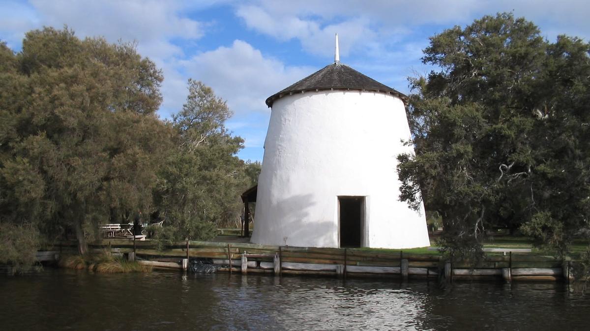
In the Shire of Murray, authorities have adopted plans aimed at reducing the threat to Cooper’s Mill, a State heritage-listed site on Cooleenup Island at the edge of the Murray River delta.
The site includes a historic flour mill, a caretaker’s residence and recreation areas. Water from the estuary enters the mill between five and 10 times in most winters, according to its caretaker, sometimes reaching a depth of about a metre and remaining for up to a week.
The Shire’s foreshore management plan addresses erosion, flooding, public access and possible protection measures, while its conservation management strategy sets priorities for preserving the building’s heritage significance. The documents are intended to support staged work and future funding applications.
Shire president Douglas McLarty said the waterways were central to the Murray region but were becoming increasingly vulnerable to environmental change.
“We know this is a key concern for our community, particularly those living in close proximity to our shorelines,” he said.
The 2010-11 Queensland floods cost the Australian economy about $30 billion, highlighting the scale of the consequences when communities are repeatedly exposed to severe weather.
Mr Nguyen said standardised assessments would not replace local knowledge or detailed engineering, but would help governments make decisions more quickly and transparently as risks evolve.
