


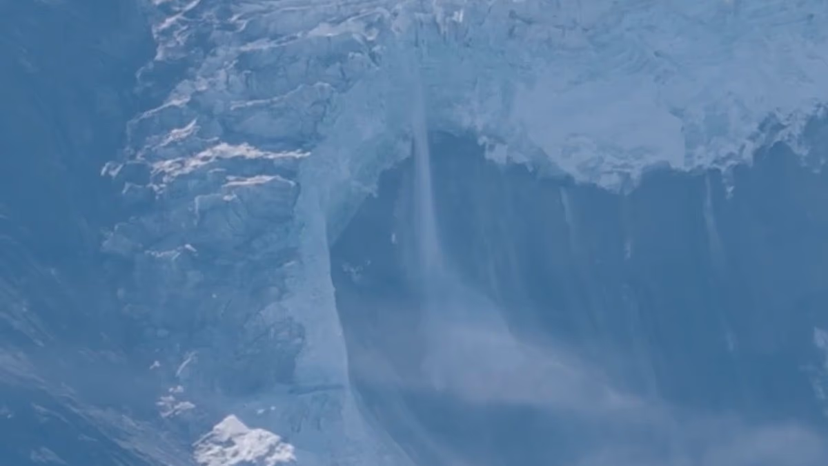
New footage shows the moment a section of glacier broke away in the Himalayas, sending ice, rock and debris crashing into a valley before a destructive torrent swept through parts of Nepal and Tibet.
The video, filmed by a Chinese tour guide in Tibet and verified by The New York Times, captures huge slabs breaking from a ridge on Langtang Lirung, a 7,200-metre peak near the Nepal-China border.
Hikers can be heard reacting to a loud crack before the mountainside gives way. A vast cloud of dust rises as the collapsing ice and rock plunge towards the valley below.
A second recording shows the debris continuing down the slope moments later, apparently marking the start of the chain of events that led to catastrophic flooding along the Lhende Khola and Trishuli river systems.
Scientists believe the collapse temporarily blocked a river and created a lake before the natural dam failed. The resulting surge gathered water, ice, boulders and sediment as it travelled downstream, destroying settlements, bridges, roads and industrial sites.
The US Geological Survey said the initial slope failure released energy equivalent to a magnitude 5.2 earthquake, although there was no earthquake trigger. Its preliminary assessment found that the debris flow travelled nearly 100 kilometres, reaching the Rasuwagadhi border crossing between Nepal and Tibet.
A second seismic event, equivalent to magnitude 4.2, was recorded about three hours later, the agency said.
The disaster struck on Wednesday, August 26, with little apparent warning. Researchers said there had been no typical combination of heavy rain, rising river levels or tremors to alert communities in the affected valleys.
The death toll has continued to rise. Nepal’s disaster authorities reported 669 deaths and 2,426 people missing, while Chinese authorities have reported seven deaths and more than 550 missing in Tibet. The combined figures put the number of dead at 676, with close to 3,000 people still unaccounted for.
Nepal’s foreign ministry said on Saturday that 626 bodies had been recovered in the country, while more than 4,450 people had been rescued, including over 187 foreign nationals. Officials warned that the figures remained subject to verification as search teams reached isolated areas.
Rescue operations have been hampered by poor weather, damaged roads and the loss of bridges across the mountain rivers. Helicopters returned to some of the worst-hit locations as conditions improved, carrying survivors to safety and delivering clothes, rice, noodles and other supplies.
At Rasuwagadhi, one of the most important crossing points between Nepal and Tibet, rescuers found that the border complex, car park, Friendship Bridge and nearby buildings had been swept away.
A Chinese team of 21 rescuers and a search dog was among the first to reach the site. Rescue worker Zou Mingqi said there was no road leading to the area and that, at the complex, “there was nothing but ruins”.
The crossing is also close to routes used by trekkers and pilgrims travelling towards the Langtang valley and Mount Kailash. More than 500 foreign tourists are reported to be among those missing, including 33 British nationals.
British care agency director Leena Bector, 53, from Slough, Berkshire, was last heard from about an hour from the border site, according to her family.
The Foreign, Commonwealth and Development Office has sent a Rapid Deployment Team to Kathmandu to support British nationals and relatives searching for missing family members. The specially trained staff are working with the British Embassy, Nepali authorities and emergency responders.
The UK has also announced £5 million in humanitarian assistance for Nepal, channelled through United Nations, Red Cross and non-governmental organisation operations.
Nepal’s foreign ministry has established an emergency control room to help identify missing foreign nationals and coordinate with families, hospitals and diplomatic missions.
Satellite images taken before and after the flooding show the scale of the destruction. Parts of the village of Syapru Besi have been washed away, while river crossings, camps, construction sites and sections of forest have disappeared beneath mud and silt.
Officials are continuing to monitor two lakes upstream of the flood zone and have warned that the risk of further flooding will remain until they have fully drained.
