


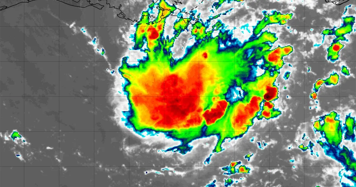
Invest 97L is being monitored in the northern Gulf of Mexico as forecasters warn that the system could bring heavy rain to parts of the Texas and Louisiana coasts this week.
The National Hurricane Center said on Sunday that the area of low pressure was about 125 miles south of south-eastern Louisiana. Its thunderstorms had become more concentrated, although surface observations showed that it had not yet strengthened into a tropical cyclone.
The system is expected to drift westwards to west-north-westwards across the northern Gulf over the next few days. The NHC puts the chance of tropical formation at 30 per cent over the next 48 hours and 30 per cent over the next seven days.
People along the Louisiana and upper Texas coasts have been advised to monitor its progress. Even if Invest 97L does not develop further, forecasters expect strong thunderstorms, gusty winds and locally higher seas over the north-central and north-western Gulf early this week.
Houston could see an increase in showers and storms by Tuesday or Wednesday as the system moves inland, with the possibility of periods of heavy rain regardless of whether it becomes a named storm.
The term “invest” is used by the NHC for a weather disturbance that has been identified for closer examination because it could develop into a tropical depression or storm.
Remnants of Tropical Storm Dolly also being watched
A separate disturbance is formed from the remnants of Tropical Storm Dolly, which was downgraded to an open tropical wave last week.
The wave was producing showers and thunderstorms across the northern Leeward Islands, the Virgin Islands and Puerto Rico on Sunday, with locally heavy rain and gusty winds expected in the region over the next couple of days.
The NHC said redevelopment was unlikely in the short term because there was no sign of a closed circulation. However, conditions could become more favourable by the middle of the week as the remnants move towards the south-eastern Gulf.
The remnants have a near-zero chance of developing during the next 48 hours and a 20 per cent chance over seven days, according to the latest outlook.
There are currently no tropical cyclones in the Atlantic basin. Should either disturbance become a tropical storm, the next names on the 2026 list would be Edouard and Fay.
