


Minnesota is set for a sharp burst of summer-like weather this weekend, with temperatures forecast to climb into the mid-80s and southerly winds potentially gusting to 40mph across the Minneapolis area.
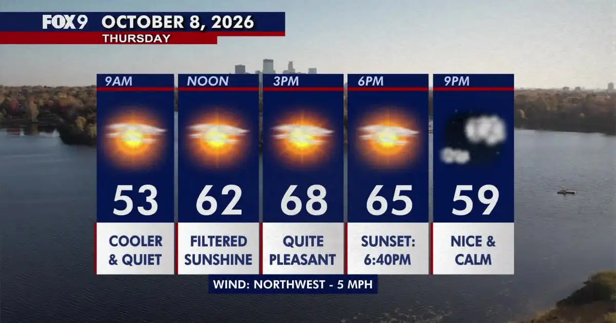
The change follows a relatively calm Thursday, when filtered sunshine is expected across much of the state. Highs should reach the 60s in most areas, with northern Minnesota remaining cooler and parts of the south and west approaching 70F (21C). Minneapolis is forecast to reach about 67F (19C), with light north-west winds. ([forecast.weather.gov](https://forecast.weather.gov/MapClick.php?FcstType=text&TextType=1&lat=44.9486&lg=english&lon=-93.2451&unit=0&utm_source=openai))
Overnight temperatures will fall into the 40s, with some 30s possible in the north, before warmer air moves in on Friday. The mercury is expected to rise into the mid-70s as winds turn south-easterly.
Warm and windy weekend forecast for Minnesota
Saturday is expected to be the warmest day of the spell, with sunshine and highs of about 84F to 85F (29C) in the Twin Cities. The National Weather Service said south winds could reach 15 to 20mph, with gusts as high as 40mph. ([forecast.weather.gov](https://forecast.weather.gov/MapClick.php?FcstType=text&TextType=1&lat=44.9486&lg=english&lon=-93.2451&unit=0&utm_source=openai))
Forecasters have also highlighted increasing fire-weather concerns as the combination of unusually warm temperatures, dry air and strong winds develops. The National Weather Service said sustained winds of 20 to 30mph and gusts of up to 40 to 45mph could occur in parts of the region on Saturday. ([beta.weather.gov](https://beta.weather.gov/tools/afd/mpx/92a85366-79dd-4129-a5cc-b56485f41416/?utm_source=openai))
Sunday should remain sunny and unseasonably warm, with temperatures around 80F (27C) in Minneapolis and winds gusting to about 25mph. Northern parts of Minnesota are expected to be cooler, although the wider state will still experience above-average temperatures. ([forecast.weather.gov](https://forecast.weather.gov/MapClick.php?FcstType=text&TextType=1&lat=44.9486&lg=english&lon=-93.2451&unit=0&utm_source=openai))
A cooler pattern is due to return on Monday, when showers could develop and temperatures fall to around 70F (21C) in the Twin Cities. Readings are then expected to drop into the upper 50s and low 60s during the early part of next week. ([forecast.weather.gov](https://forecast.weather.gov/MapClick.php?FcstType=text&TextType=1&lat=44.9486&lg=english&lon=-93.2451&unit=0&utm_source=openai))
