


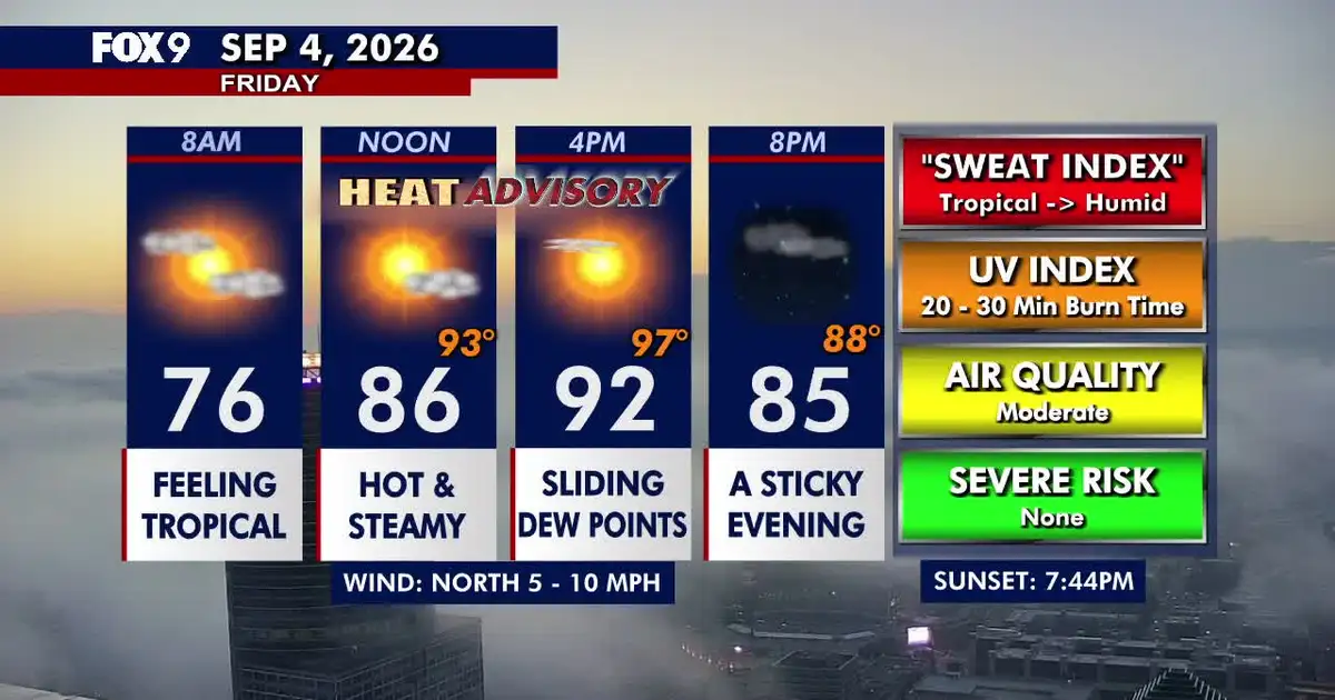
A heat advisory has been issued for the Twin Cities metropolitan area as temperatures are expected to reach about 33C on Friday, September 4, with humidity making it feel closer to 36C.
The National Weather Service has put Anoka, Carver, Dakota, Hennepin, Ramsey, Scott and Washington counties under the advisory from 1pm to 6pm local time. Heat index values could reach 36C, with officials warning that the combination of high temperatures and humidity may lead to heat-related illness. ([forecast.weather.gov](https://forecast.weather.gov/showsigwx.php?firewxzone=MNZ060&local_place1=Minneapolis+MN&product1=Heat+Advisory&warncounty=MNC053&warnzone=MNZ060&utm_source=openai))
Residents have been advised to drink plenty of fluids, remain in air-conditioned rooms where possible and avoid prolonged exposure to direct sunlight. Strenuous outdoor activity should be limited, particularly during the hottest part of the afternoon.
Hot and humid conditions across Minnesota
Friday will begin with some cloud and patches of fog before skies brighten and sunshine becomes more widespread. Winds will remain light, generally between 8 and 16kph, while dew points ease slightly through the afternoon.
Central and southern Minnesota are expected to reach the upper 20s and low 30s, while northern parts of the state remain cooler, with temperatures in the 20s. Minneapolis and St Paul are forecast to reach around 33C, with heat index values approaching 36C. ([forecast.weather.gov](https://forecast.weather.gov/MapClick.php?FcstType=text&lat=44.9201&lg=en&lon=-93.2522&unit=0&utm_source=openai))
Cloud will return overnight, with patchy fog developing late. Lows will remain around 19C to 22C in central and southern Minnesota, while northern areas could fall into the low teens. A stray thunderstorm remains possible in the far south-west of the state.
Saturday will stay hot and humid, although conditions should be marginally less intense. Temperatures in the Twin Cities are expected to reach about 32C, with heat index values in the low 30s. The National Weather Service is also forecasting afternoon heat index readings of roughly 35C across parts of southern Minnesota and western Wisconsin. ([forecast.weather.gov](https://forecast.weather.gov/showsigwx.php?firewxzone=MNZ060&local_place1=Minneapolis+MN&product1=Heat+Advisory&warncounty=MNC053&warnzone=MNZ060&utm_source=openai))
Showers may develop overnight into Sunday, before temperatures ease back to the high 20s. Thunderstorms are possible on Sunday evening and overnight, with further isolated storms potentially lingering into Monday and Tuesday.
Labor Day on Monday is expected to be more comfortable, with highs in the low 20s. Warm and humid conditions, with temperatures in the 20s, are forecast to persist across much of Minnesota next week.
