


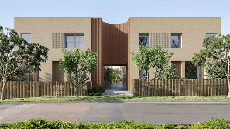
Luxury townhouses already approved and under construction in Melbourne are being reassessed after updated flood mapping placed their Brunswick site inside a new flood zone, raising concerns about the gap between planning and building approvals.
Work is under way on the 24-home development at 144-146 Union Street, where excavators are carving out underground car parks for the $40 million Neometro project. Several of the architect-designed three-bedroom properties, advertised at prices ranging from $1.6 million to more than $2.2 million, have been pre-sold.
The development received planning approval from Merri-bek council in June 2025 and had also been issued with a building permit by a private building surveyor. But in January, the site became subject to a Special Building Overlay, requiring a planning permit for works intended to reduce the impact of flooding.
The application was referred to Melbourne Water, which is responsible for floodplain management. The authority has since provided advice on minimum flood protection and floor-level requirements, although the full effect on the project remains unclear.
Melbourne Water executive general manager Chris Brace said flood maps did not create a hazard but revealed one that was already present.
“Flood mapping does not create risk; it identifies the risk that already exists,” he said.
The Victorian Government says Melbourne Water began releasing revised flood maps across Greater Melbourne in October 2025, with the process due to take place in stages over two years. The new information is being progressively incorporated into local planning schemes so future developments can be assessed against updated flood risks. ([planning.vic.gov.au](https://www.planning.vic.gov.au/news/articles/new-flood-risk-tools-to-make-homes-more-climate-resilient))
Brunswick development caught between two approval systems
Merri-bek council said the development would require amended permits and further statutory processes following Melbourne Water’s assessment.
“Mapping flood-prone land through the special building overlay gives property owners and developers clear information about flood risks and the requirements that must be addressed during the planning process,” a council spokesman said.
The state’s planning guidance defines a Special Building Overlay as a control for urban land that may be affected by overland flows when stormwater drainage systems are overwhelmed during heavy rainfall. It is intended to ensure that new construction does not obstruct floodwater, increase flood levels or worsen conditions for neighbouring properties. ([planning.vic.gov.au](https://www.planning.vic.gov.au/guides-and-resources/council-resources/practitioners-guide-to-victorias-planning-schemes/choosing-and-applying-provisions?SQ_ACTION=login))
Neometro director James Tutton declined to say whether the homes would need to be altered or whether purchasers had been specifically informed about the updated mapping.
He said the company’s design team had made the necessary applications and technical amendments as part of the project’s approvals process.
“As is always the case, our expert design team proactively made all relevant applications and technical amendments to meet regulatory obligations,” Mr Tutton said. “This covers the full gamut of issues including flood risk.”
One prospective buyer, who asked not to be named, said he had placed a deposit on one of the townhouses before the overlay was applied, but later withdrew from the purchase for reasons unrelated to the flood mapping.
“We had a serious look at four of the units,” he said. “We eventually withdrew, but we never had anything mentioned about flood risk or flood mapping.”
Planning experts say similar problems are likely to emerge elsewhere in Melbourne as older flood modelling is replaced.
Jane Keddie, vice-president of the Victorian branch of the Planning Institute of Australia, said many areas had not previously been identified because flood models and planning overlays had not kept pace with development.
“Because of the delay and the outdatedness of a lot of the current modellings, there will certainly be a difficult transition period where we do have development that’s been approved in what are essentially floodplains,” she said.
Ms Keddie said the current system created a disconnect between the two main approval stages. For some residential projects of fewer than seven storeys, councils could not consider flood risk when deciding planning applications if a relevant overlay was not yet in place, while Melbourne Water could become involved later during building approval.
“At the moment, we have a significant disconnect between the planning approval stage and the building approval stage,” she said.
A Department of Transport and Planning spokesman said development could still proceed in flood-prone areas where it met appropriate design, construction and flood-protection requirements.
The number of Melbourne developments affected by the updated mapping has not been established. Merri-bek, Yarra and Melbourne councils were unable to provide figures for the properties in their municipalities.
Nearby resident Rob Veitch said he had not experienced flooding at his home but had discovered standing water when digging for a retaining wall. He was later told by the council that the flood mapping for his property had changed.
“My understanding is just if it rains, there is nowhere for the rain to go,” he said.
