


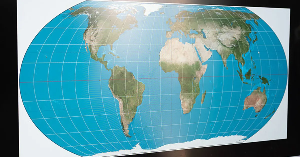
The United Nations General Assembly has backed a non-binding resolution encouraging the use of the Equal Earth projection, a world map designed to represent the relative size of continents more accurately. The measure passed on 4 September with 164 countries in favour, the United States opposed and six abstentions. ([please.untaint.us](https://please.untaint.us/?url=https%3A%2F%2Fpress.un.org%2Fen%2F2026%2Fga12779.doc.htm&utm_source=openai))
Sponsored by Togo and supported by the African Union, the resolution seeks to challenge the dominance of the Mercator projection, which has been widely used since the 16th century.
Equal Earth map backed by UN vote
Mercator was developed by Flemish cartographer Gerardus Mercator for maritime navigation. It preserves direction, making it useful for plotting courses, but enlarges landmasses as they move further from the Equator.
As a result, Greenland can appear similar in size to Africa on a conventional map, despite Africa being about 14 times larger. The Equal Earth projection preserves the relative area of continents more accurately, although it cannot reproduce every aspect of the globe perfectly on a flat surface.
The resolution does not ban Mercator or make Equal Earth compulsory. Instead, it encourages governments, schools, international organisations and technology companies to consider equal-area projections when the relative size of landmasses is important. It also stresses that different projections remain suitable for different purposes, including navigation. ([un.org](https://www.un.org/osaa/en/news/victory-africa-un-votes-resolution-correct-map?utm_source=openai))
Togo’s Foreign Minister Robert Dussey told the Assembly that maps influence education and public perceptions. He argued that correcting distortions would provide a more accurate and balanced view of the world.
The United States was the only country to vote against the resolution. Its representative said Washington viewed the initiative as part of a wider ideological project and criticised it as a distraction from what it described as the organisation’s central responsibilities.
Estonia, Georgia, Lithuania, Moldova, Serbia and Ukraine abstained. Ukraine said it supported more accurate representations of continental landmass but objected to how some Equal Earth maps depict territory occupied by Russia, warning that cartographic material should not create confusion over sovereignty or borders. ([transcripts.un.org](https://transcripts.un.org/en/ga/80/114?t=3519&utm_source=openai))
The United Kingdom voted in favour, while making clear that the resolution had no effect on territorial status, internationally recognised borders or sovereignty. The UK also said it did not regard historical map projections themselves as a historical injustice requiring redress through the United Nations. ([transcripts.un.org](https://transcripts.un.org/en/ga/80/114?t=3519&utm_source=openai))
The resolution’s supporters said the vote was intended to address the educational and symbolic impact of maps, particularly the way Africa and other regions close to the Equator have often appeared smaller than they are in reality.
Although the decision has no legal force and will not immediately change maps used around the world, it gives international backing to a campaign led by African states to promote cartographic representations that better reflect the true proportions of the continents.
