


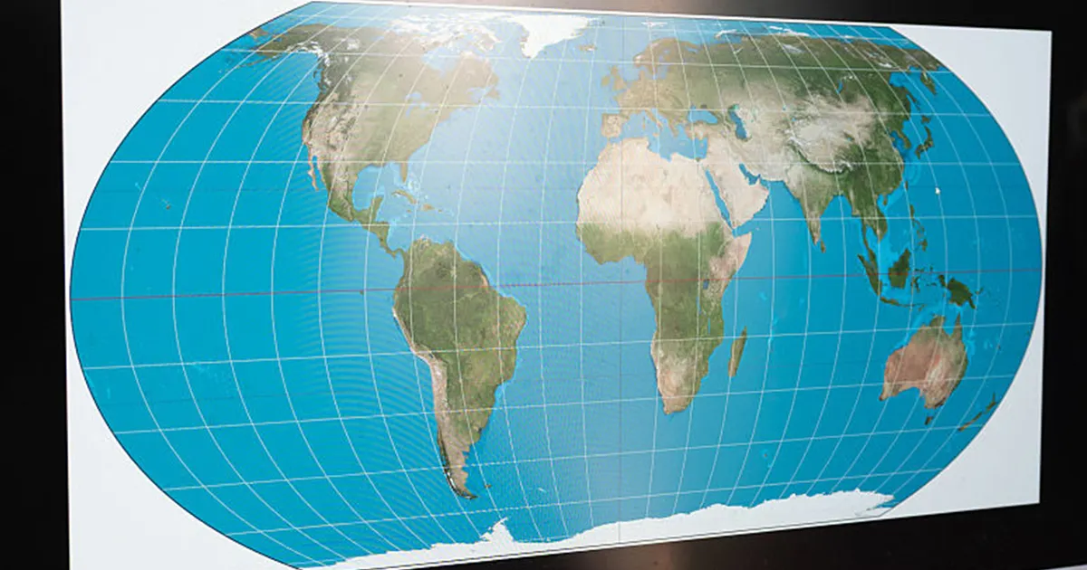
The United Nations General Assembly has backed a resolution encouraging wider use of the Equal Earth projection, a world map designed to show the relative size of continents more accurately than the familiar Mercator map.
The non-binding measure was approved on 4 September 2026 by 164 votes to one, with six abstentions. It does not outlaw the Mercator projection or require countries, schools or mapmakers to replace it.
Equal Earth projection backed by UN
Equal Earth is an “equal-area” projection, meaning it preserves the relative size of land masses when the globe is represented on a flat surface. Under the projection, Africa appears vastly larger than Greenland, rather than roughly comparable in size as it can appear on a Mercator map.
The Mercator projection was developed by the Flemish cartographer Gerardus Mercator in the 16th century, primarily to assist maritime navigation. Its method preserves directions, but increasingly exaggerates the size of regions further from the Equator, including Greenland, Canada and northern Europe.
The initiative was led by Togo and supported by the African Union. Togo’s Foreign Minister, Robert Dussey, told the Assembly that maps influence education and collective perceptions, as well as shaping how people understand the world.
The resolution urges governments, educational institutions and technology companies to consider projections that give a more accurate impression of continental areas. It also acknowledges that no flat map can represent every aspect of the globe without some distortion.
The United States was the sole country to vote against the measure. In its explanation of vote, the US delegation said the proposal was linked to a wider ideological project and argued that the UN should focus on international peace, prosperity and relations between countries.
Serbia, Estonia, Georgia, Lithuania, Moldova and Ukraine abstained. Ukraine said it supported efforts to address distortions in the depiction of continental size but objected to how some Equal Earth maps represent Ukrainian territory occupied by Russia.
The United Kingdom voted in favour but raised similar concerns about the depiction of territorial boundaries. Its representative stressed that the resolution did not alter sovereignty, borders or the legal status of disputed territories, including Crimea.
The measure therefore changes no borders and has no legal force over national mapping practices. Its immediate effect is to give international backing to the use of Equal Earth and other equal-area projections for educational and awareness purposes, while leaving navigational charts and existing mapping systems untouched.
